Texel Range Deathmarch Weekend
Friends: Only God!Location: Hochwilde
Elevation gain: 4110m = 2080m + 2030m
Also posted at Summitpost here
The Joy of Hiking...
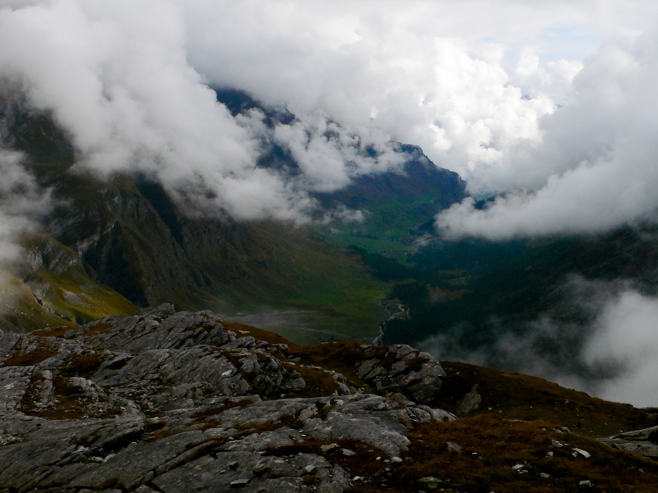
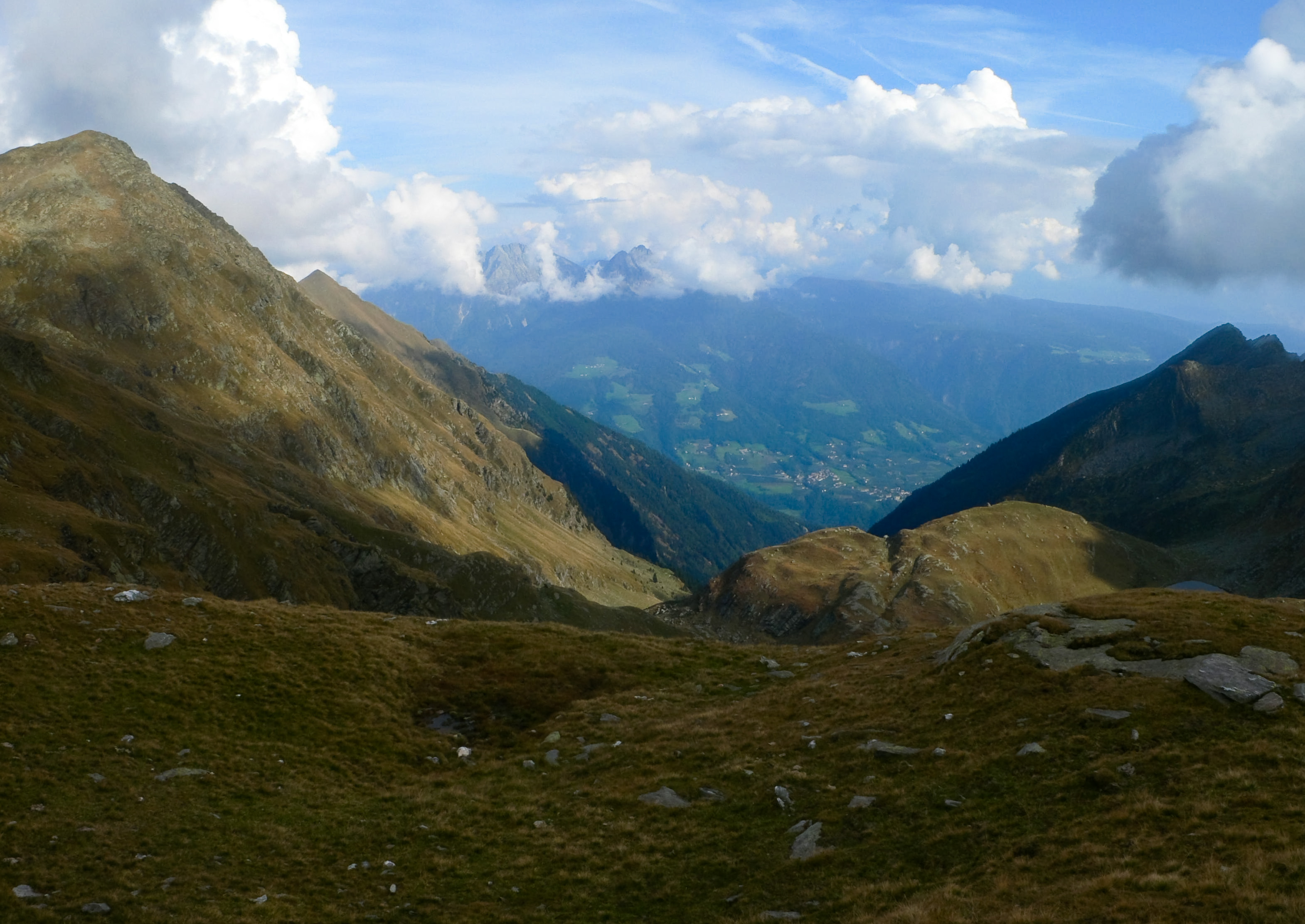
Clouds burning off of the beautiful Pfelderer Valley.
I always return to hiking.
There is nothing like a hard day of tramping over the hills, crossing new passes and basking in the atmosphere of a strange new range. Many of my friends who climb have no use for hiking, as an activity in it's own right. However, I think hiking is the spiritual center of mountain appreciation. All of us here know the perils of mechanical uplift, and that meaningful views only come with sweat equity. But another danger (on the other side, so to speak) besets the spirit of the mountaineer: the pursuit of an ever-increasing ladder of technical goals, of "must do" climbs. It's fun and exhilarating to embark on such quests, and I spend most of my mountain time doing exactly that. But the negative aspects of this goal-oriented thinking can't be ignored:
- So much stress about the weather! It must be perfect!
- Logistics: the right partner, the right gear, the right climb. It's not relaxing!
- A lingering sense of futility. One "big climb" done just opens the door to more. New, different and better lists form in your brain. The "work" never ends!
- How "hard" do you want to climb anyway, how much objective hazard do you want to accept? How much of what you are doing truly comes from you, and how much from your peers or pictures in magazines?
The smart thing to do is put the burden down sometimes. We all have goals to achieve...and we are better for them. But sometimes we just need peace. No expectations.
Day One
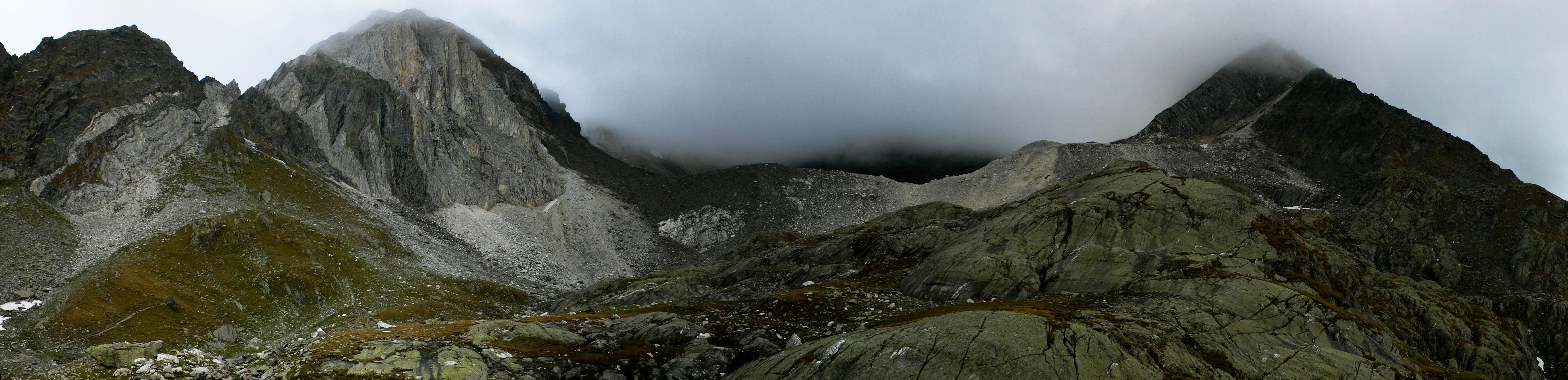
The Texel Range is hard against the Italian/Austrian border just north of Meran, Italy. It's part of the Oetztal Range. I'll use the German names for peaks and passes as that still matches the prevailing culture of the place. Two popular long-distance trails snake across the country, the Meraner High Way and the Tyroler High Way. Aside from those trails, this country is very lonely. After the August high season, you may even walk for hours on those trails without seeing anyone. There are extensive walks above timberline and many satisfying view peaks to gain, often with trails to the top. I loved the lonely feeling here!
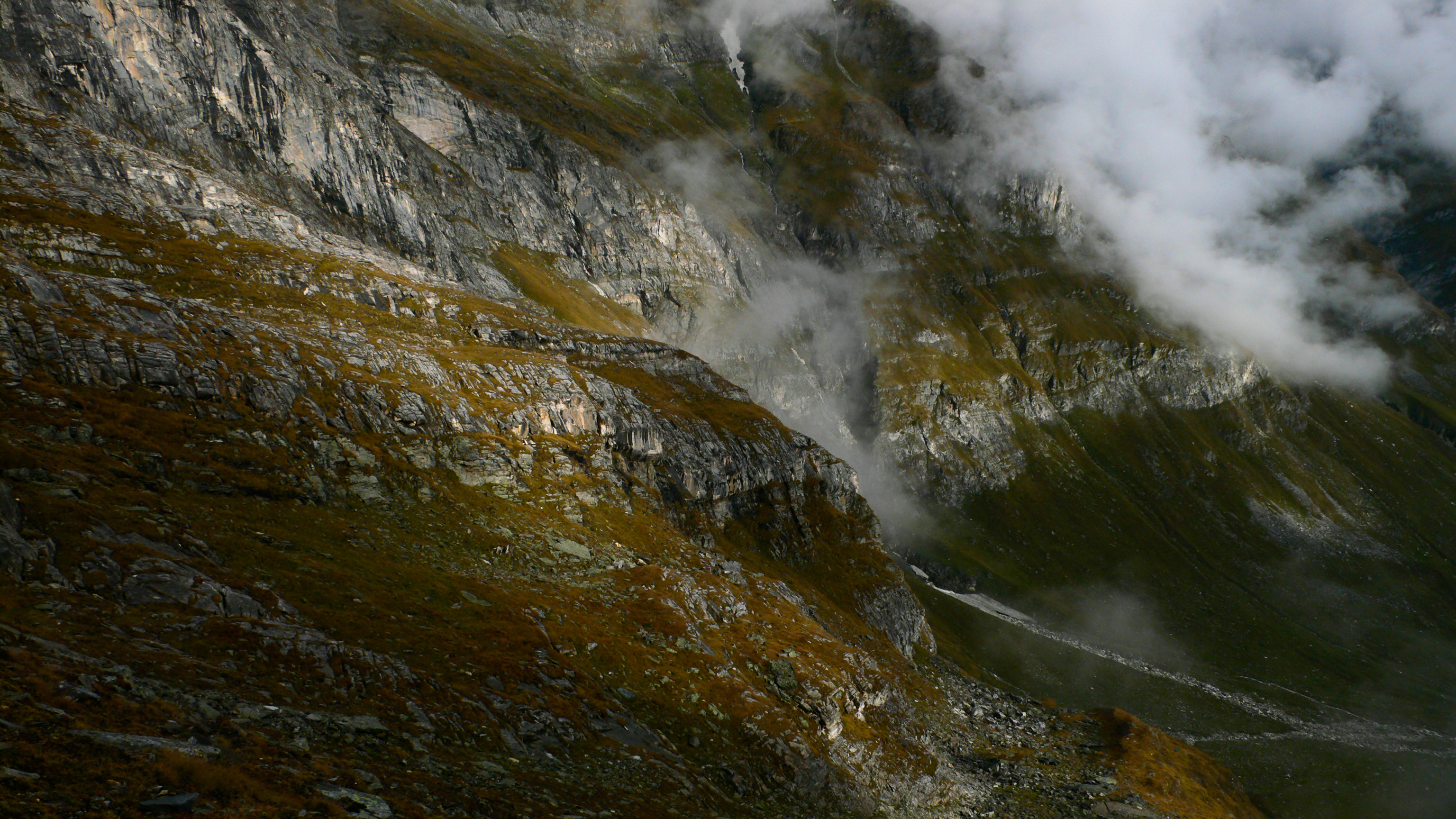
Dramatic cliffs and clouds burning off of the Gurglerkamm.
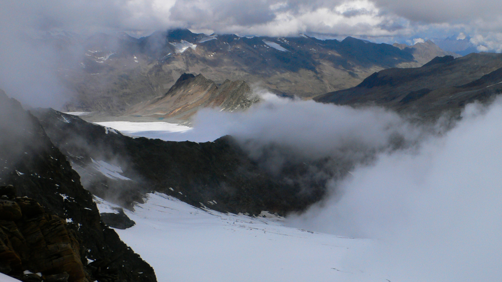
Looking north into Austria from the summit of the Hochwilde.
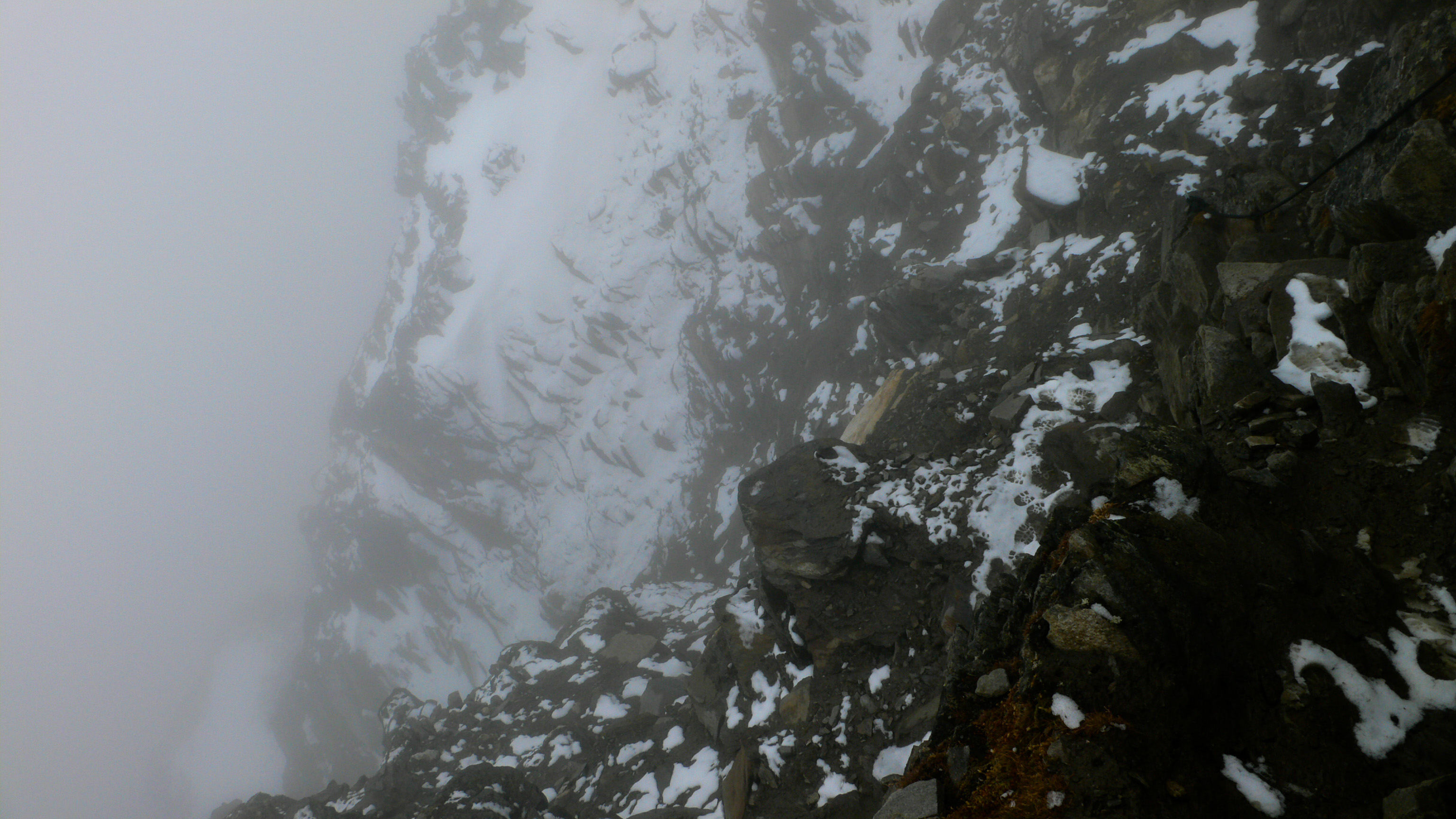
With fresh snow, the trail up the Hochwilde required care in spots.
I only had a weekend, but wanted to see as much of the country as possible, so my itinerary was ambitious or insane, depending. I started with a 1 hour bike ride up a dirt road from Pfelders, the highest farming valley in Tyrol at about 1600 meters. Once I started walking up trail from there, I left the trees behind until Sunday night. I climbed to the Eisjochl, then after some soup at the Hut there, I hiked steeply up to the summit of Hochwilde at around 3500 meters. This marks the border with Austria. In blowing clouds I could see north into that country, golden valleys miles away across the glaciers at my feet. Only a few miles to the west was where Ötzi "the ice man" was found coming out of a glacier.
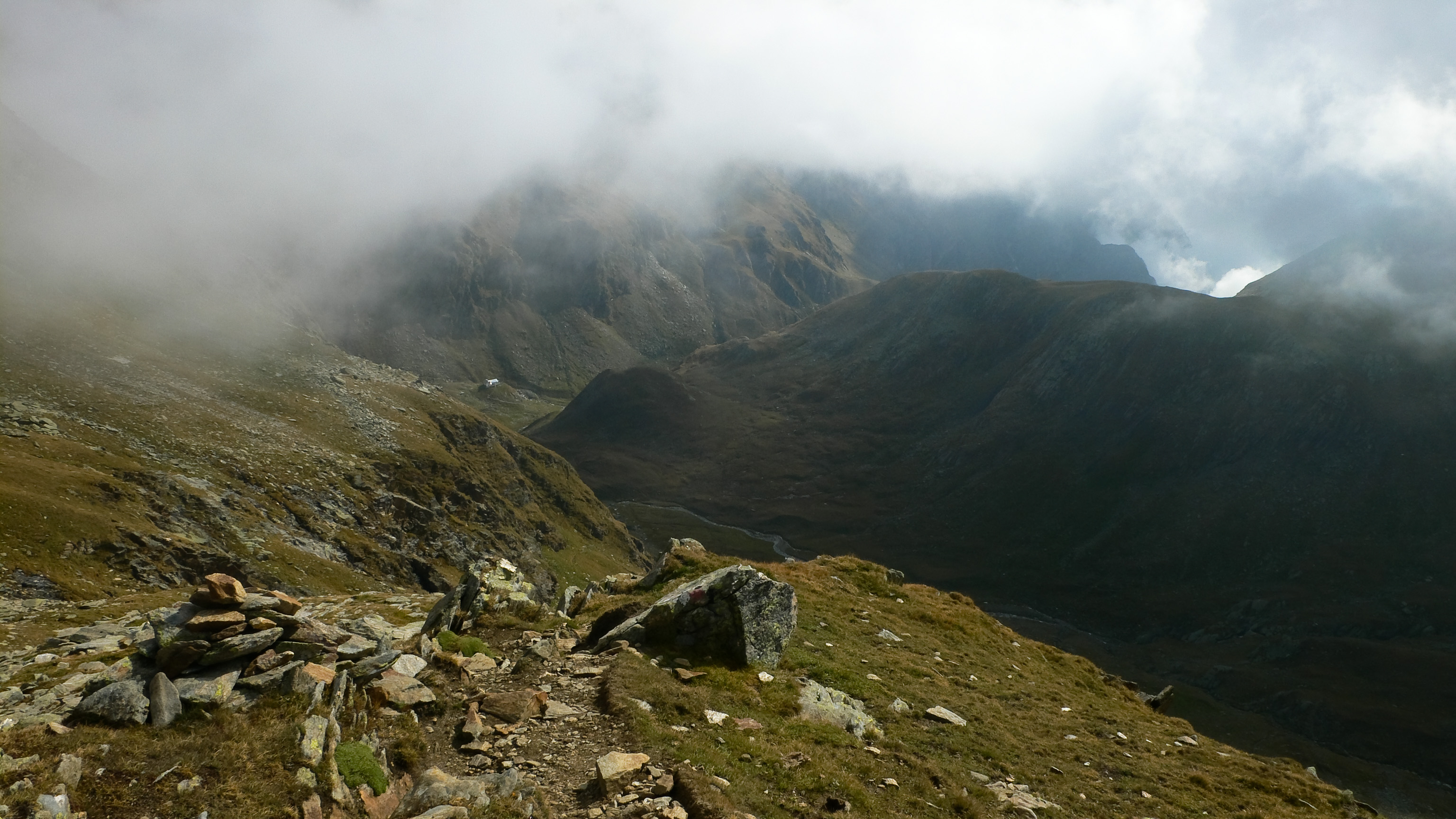
Descending into clouds, I walked to a barren lake then climbed to the Johannesschartl, a narrow pass with a descent into the Zieltal. An umbrella was handy against occasional rain showers here. Not wanting the day to end, I walked slowly down valley, enjoying the somber mist-enshrouded peaks. Around 4:30 I reached my goal for the day, the Lodner Hut. Warm drinks and a heaping plate of spaghetti for dinner, followed by some beer and wine sent me to my bunk well-pleased with the day.
Hohe Weiße and Lodner as seen from the west
Looking down the Zieltal from the Johannesschartl.
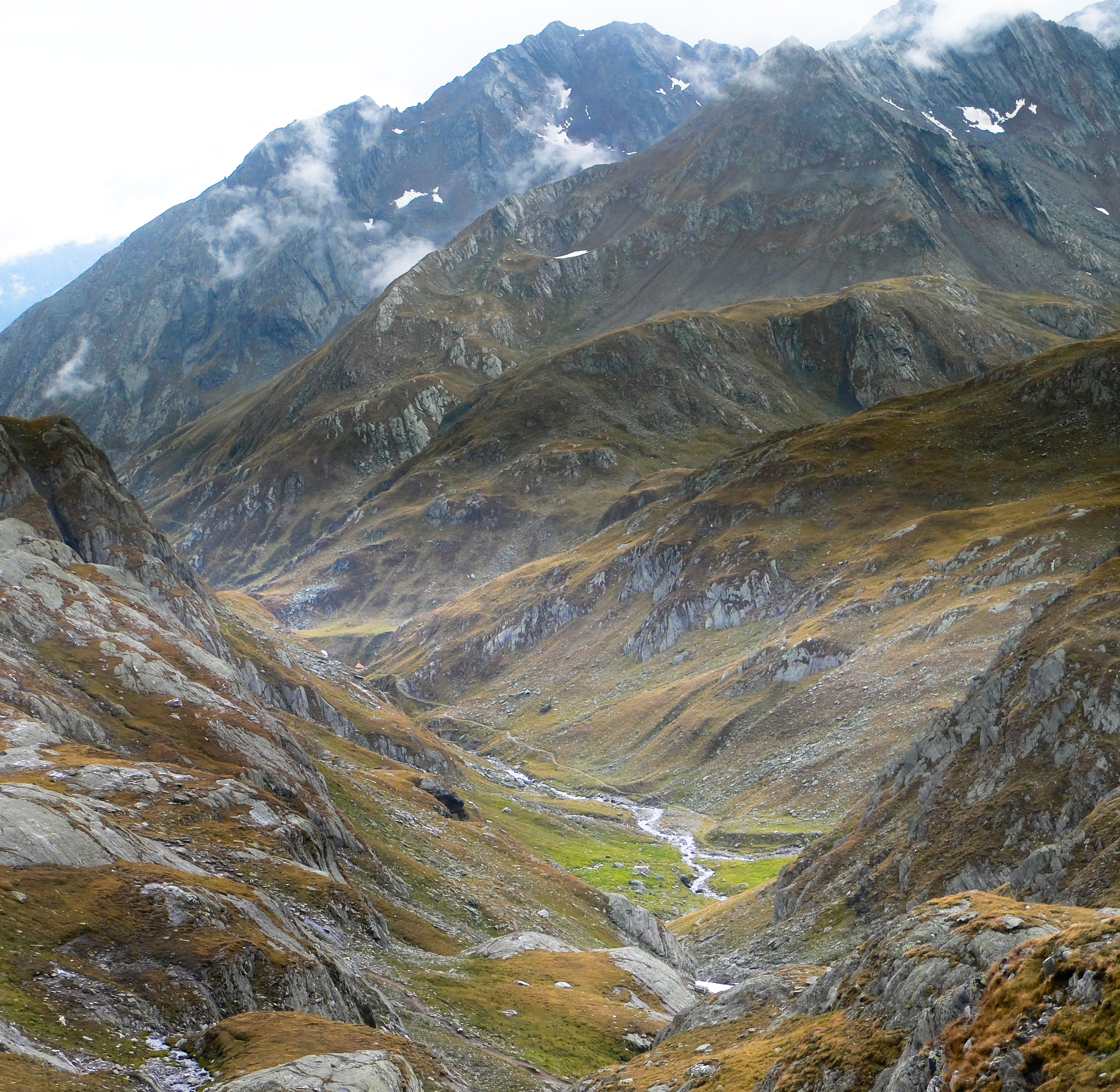
The Lafais Valley. On the upper right is the Kalberalm meadow.
I was missing my hiking poles though! I'd left them at home by accident. My left knee was pretty sore from such a big day, with the next day promising even more! I hoped for clear skies in the morning.
During and after dinner I read a book called "Handling the Undead," by the author of the excellent horror book/film "Let the Right One In." It was okay.
Day Two
Heading down from Roteck, as clouds rise to meet me.
Breakfast at 7, then scrambling out to the west under blue sky. Who knows how long it will last? Better hurry!
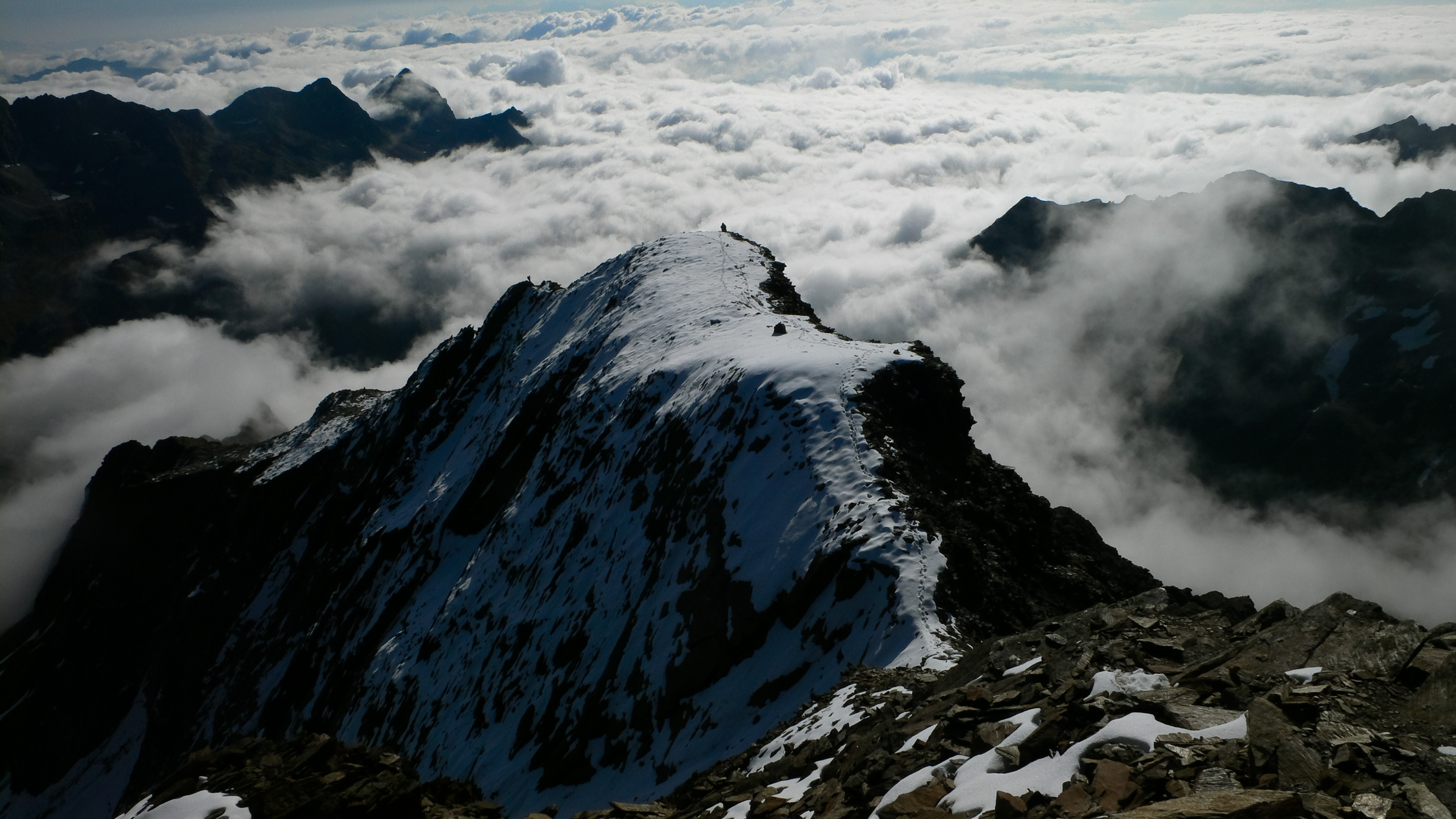
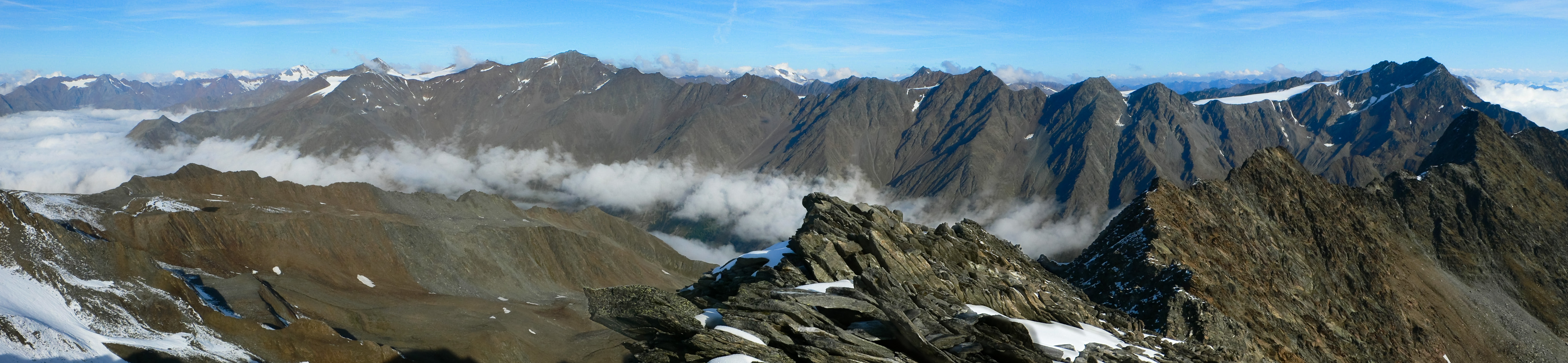
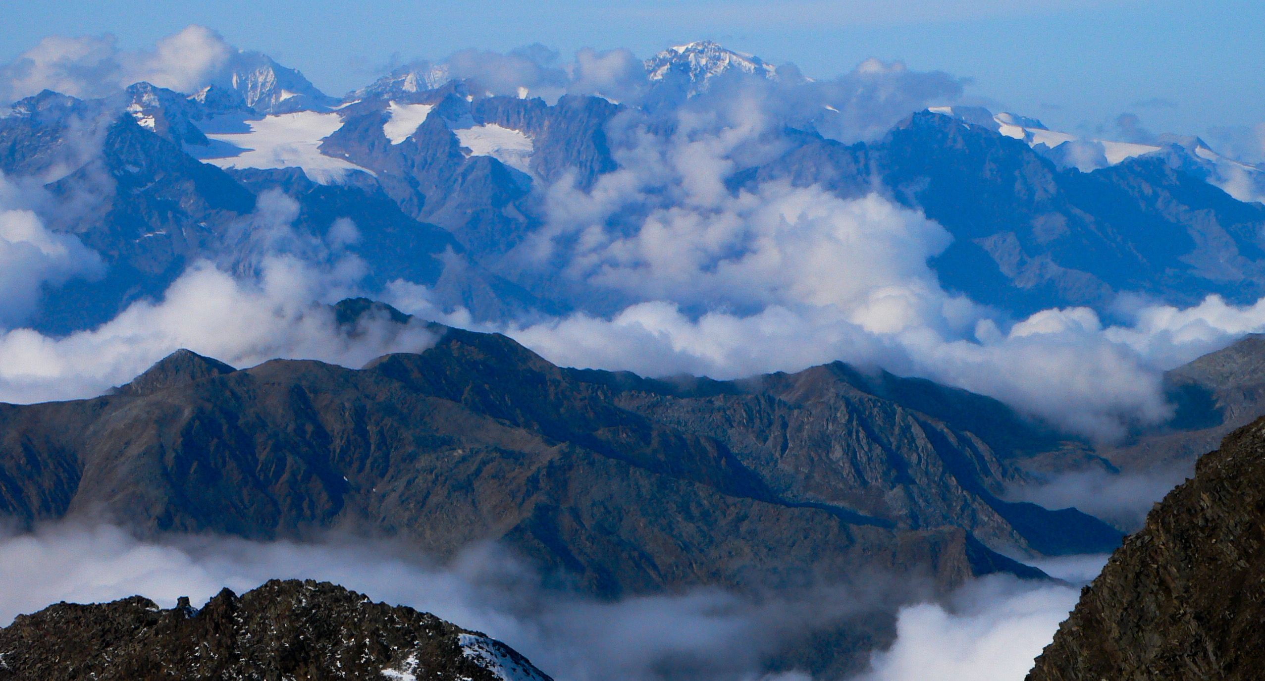
The summit of Roteck is the highest of the Texel Group proper, and I was eager to enjoy it's 360 degree panoramic view. I said good morning to three Italians on the trail and climbed the increasingly interesting ridge. Eventually, metal cables protected the traverse of smooth granite slabs on the ridge. Icy patches of snow kept me attentive, and after two hours I was on top. The view swept from the Dolomites in the east to the Ortler in the west, and all the Austrian frontier peaks on the north sweeping between. Clouds were boiling up from the lowlands, and with some dismay I saw my proposed route for the afternoon become quickly swallowed by the mist. Oh well!
I soaked up the sun on the descent, knowing it wouldn't last forever. Back at the hut I had some cake and coffee, then set off once more to climb to the Halsljoch. This beautiful hike in and out of sun was a high point. Looking down to the Ziel Valley far below was always interesting, and the route kept going around corners and revealing new vistas.
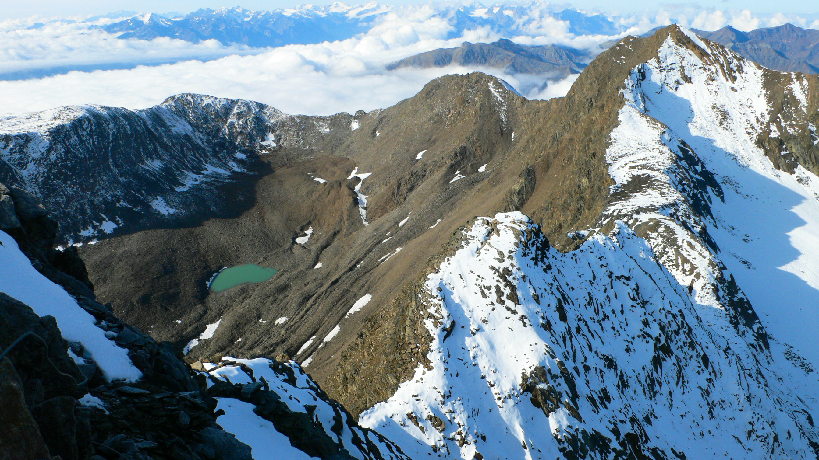
The Texelspitze with the Blaue Lake beneath. The map still shows a glacier emptying into the lake, but it is gone.
The Hochwilde, which I climbed the day before is on the far right. The clouds are snaking up the long Pfossen valley.
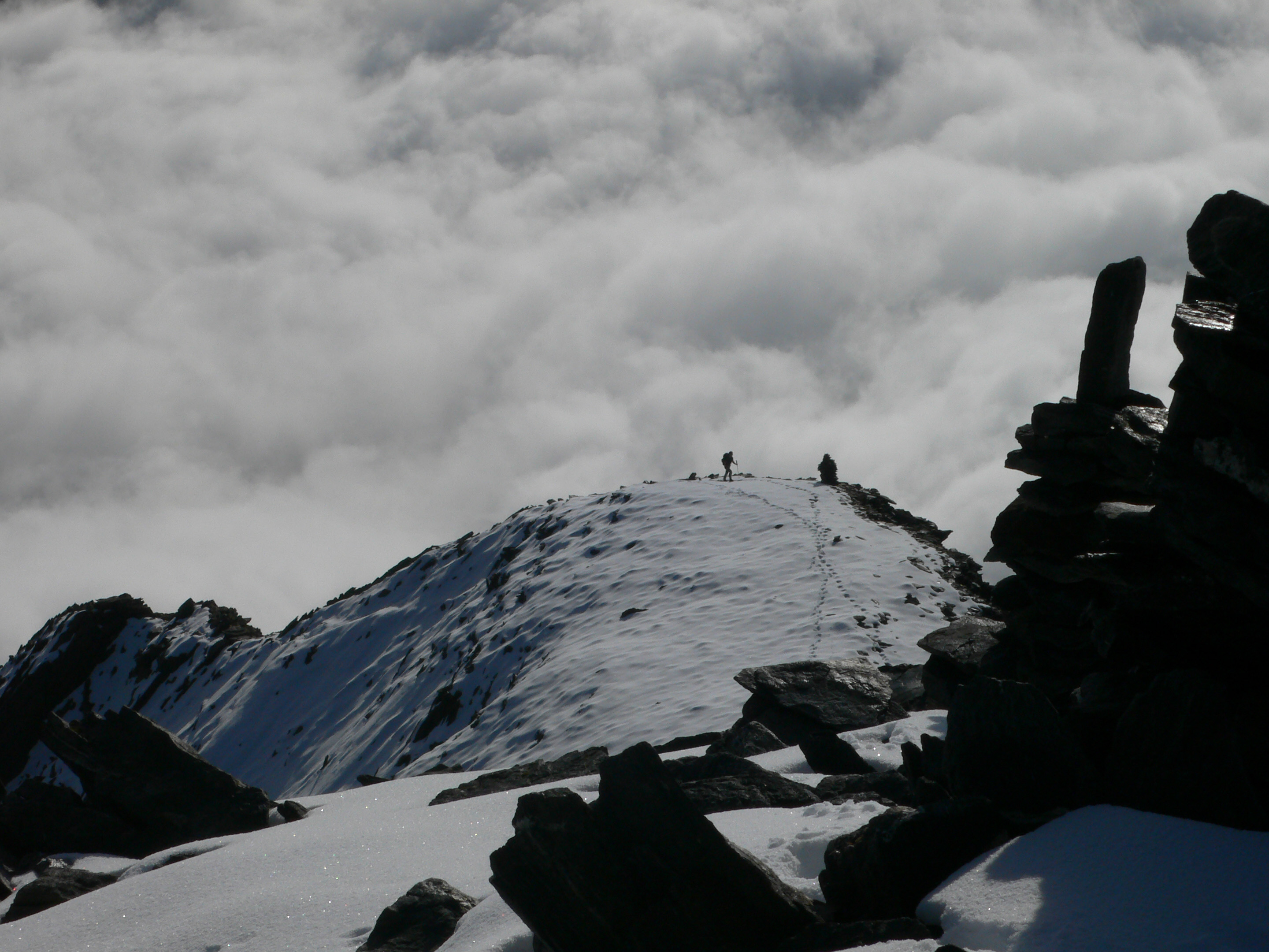
A party of three makes their way to the summit of Roteck (3337 m).
I believe the peak in the center back is the Ortler, with the Königspitz on the left.
On the summit of Roteck, happily exploring a new area of the mountains.
Approaching the Lodner Hütte, descending from Roteck.
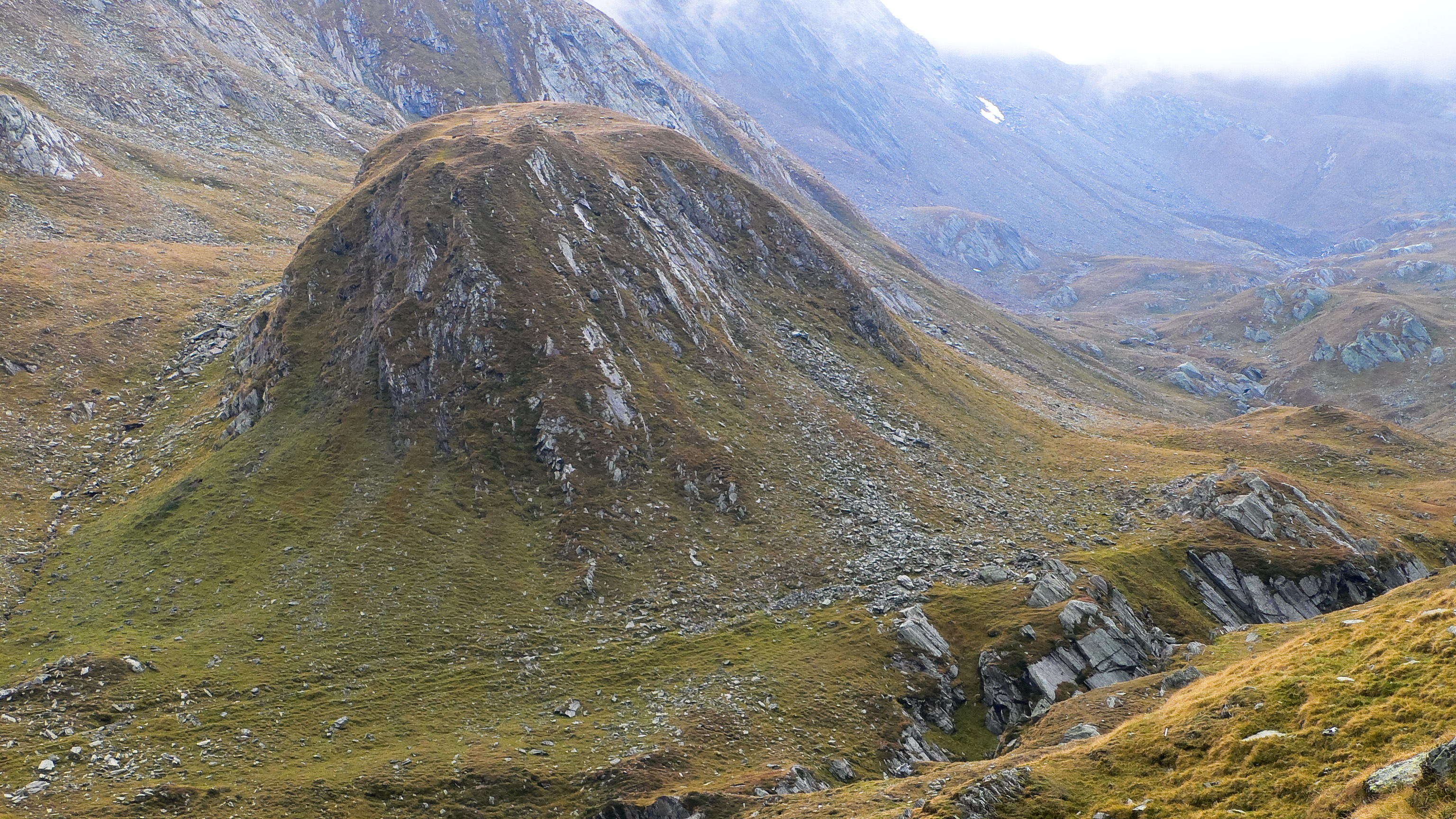
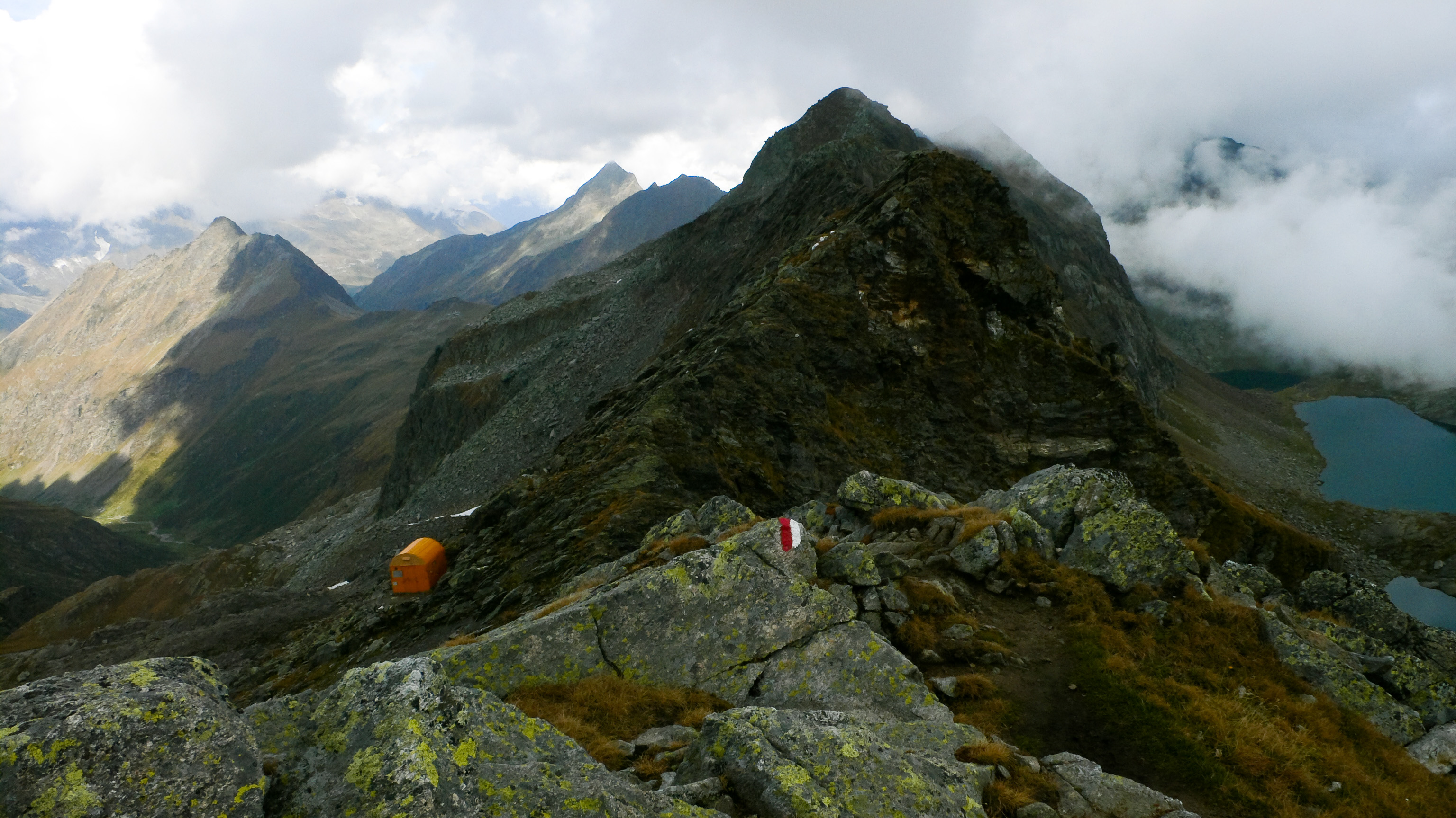
At the Halsljoch I couldn't resist the 500 foot climb up to the Lazinser Roetelspitz. There is a compulsion in this rumpled quilt terrain to collect highpoints and triangulate them against each other. This would be my third, last, and lowest of the 3000 meter peaks I'd collected this weekend. My aching knee really felt the descent, but there was more to do.
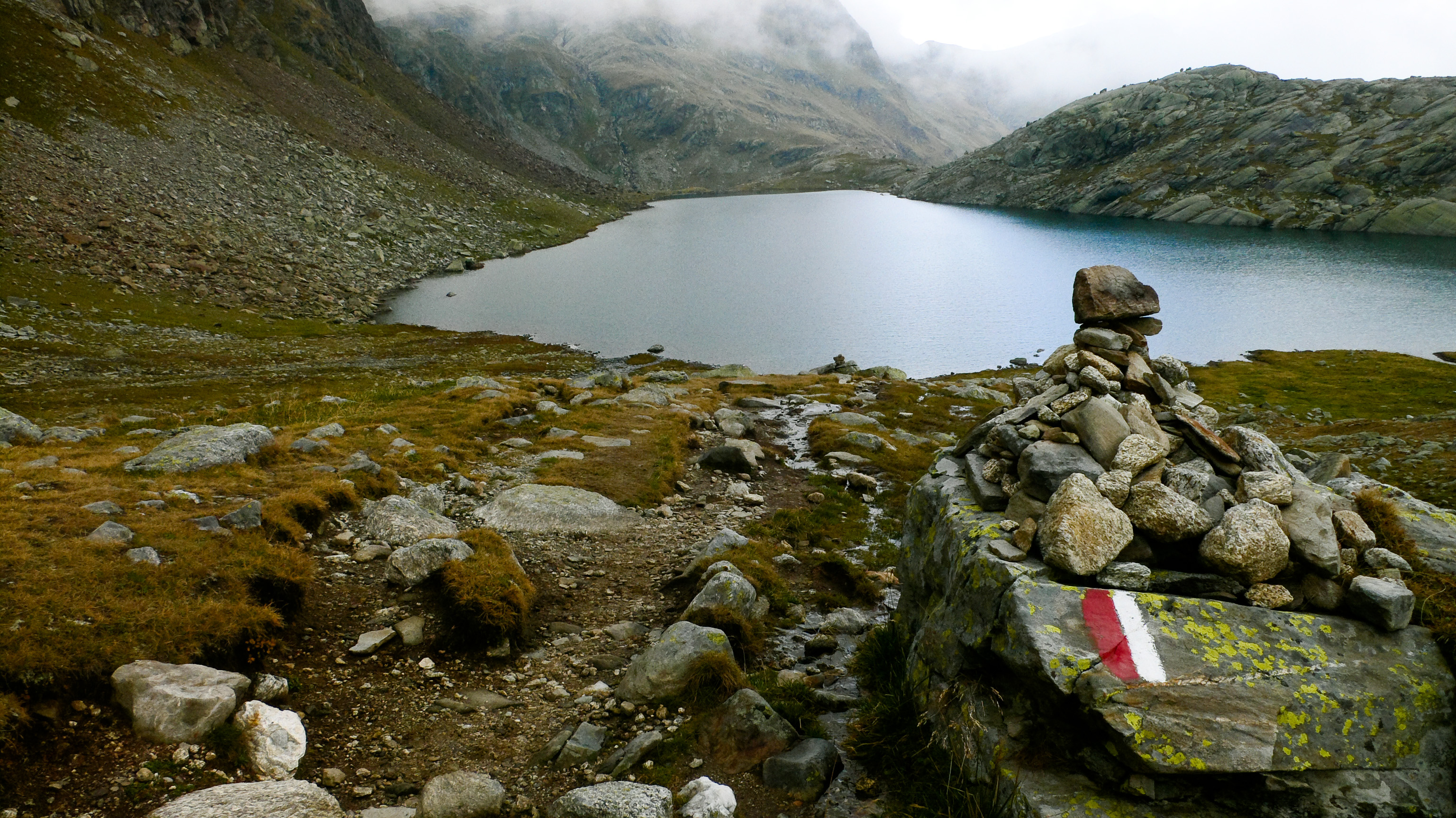
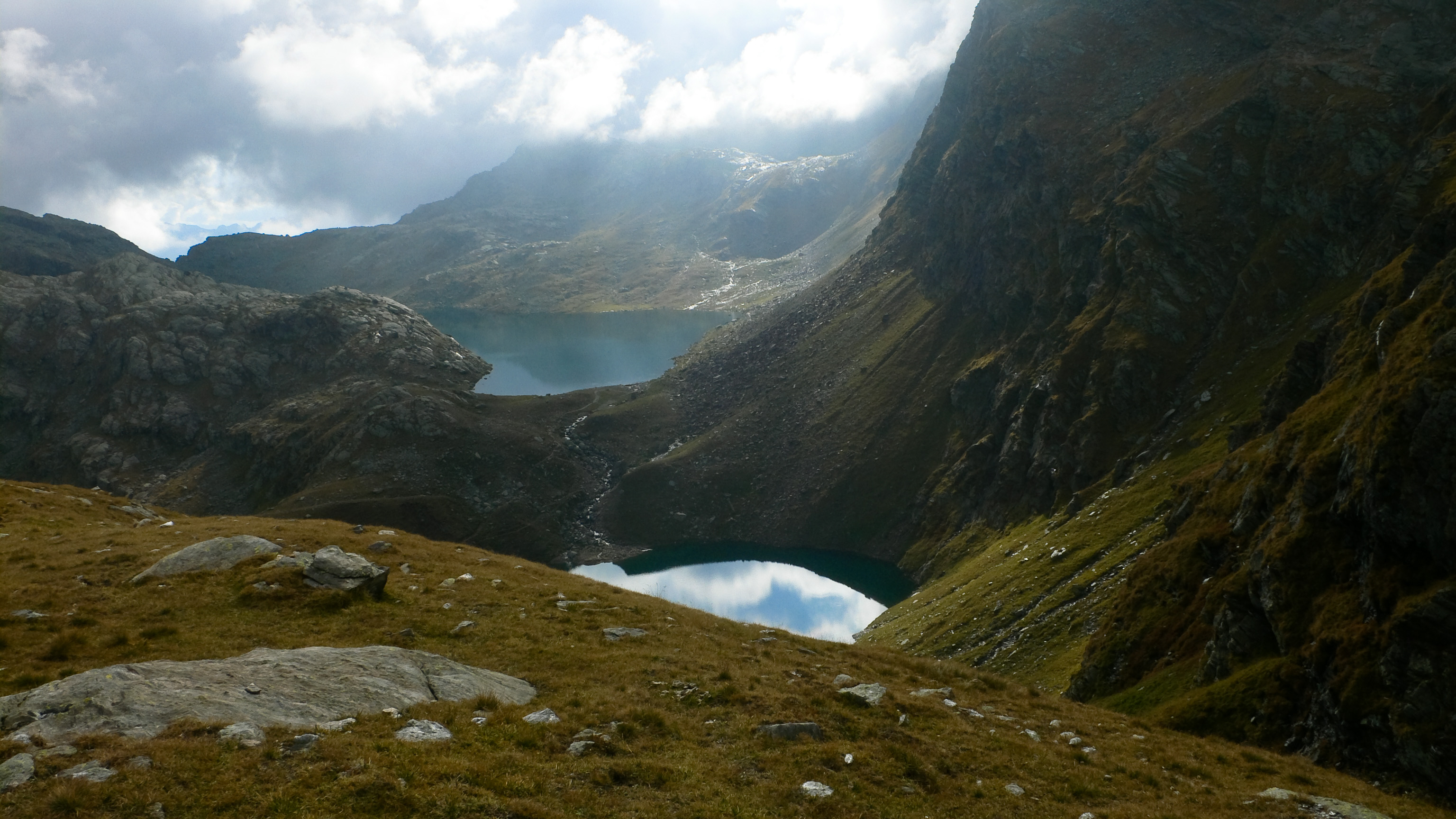
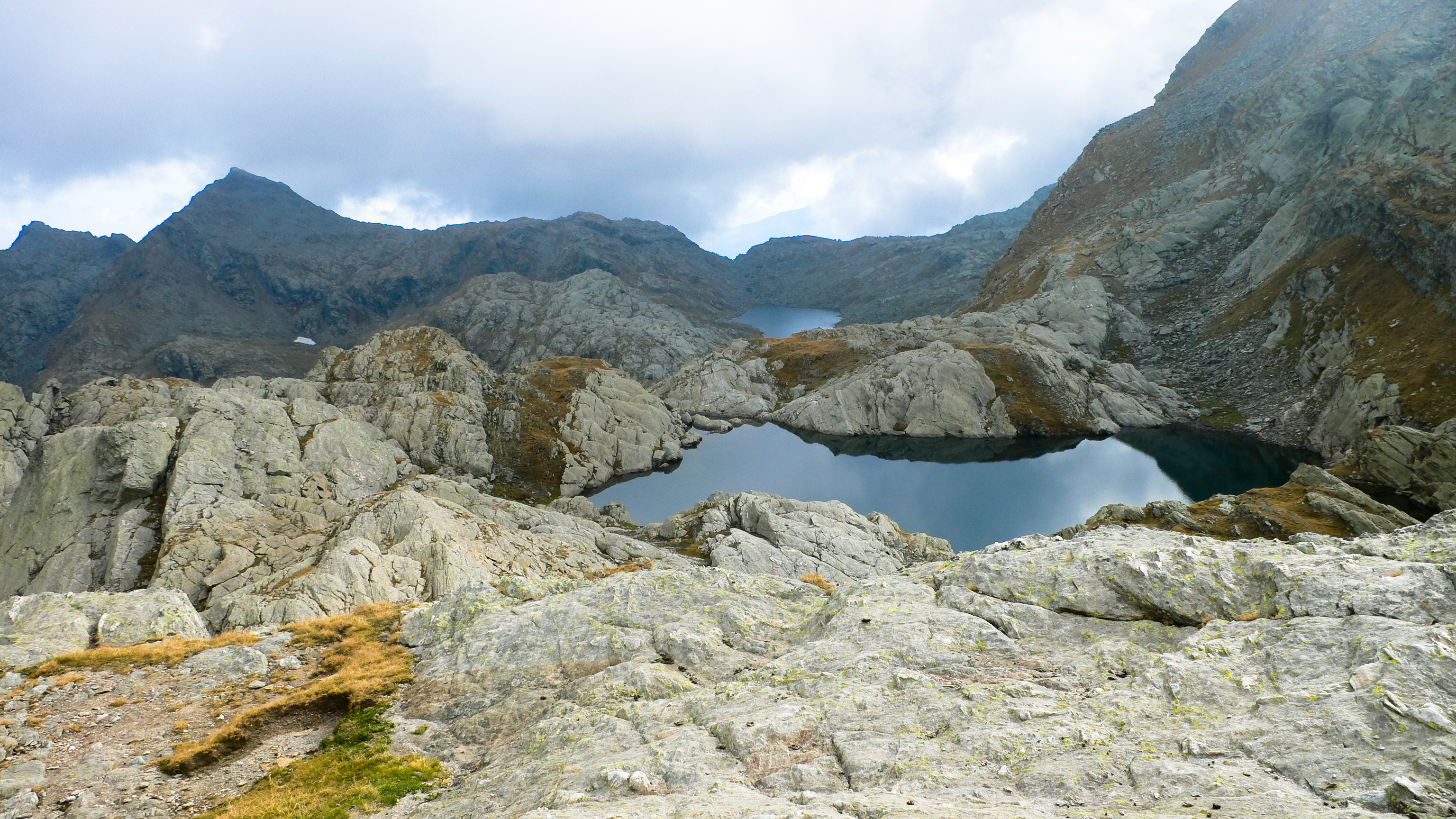
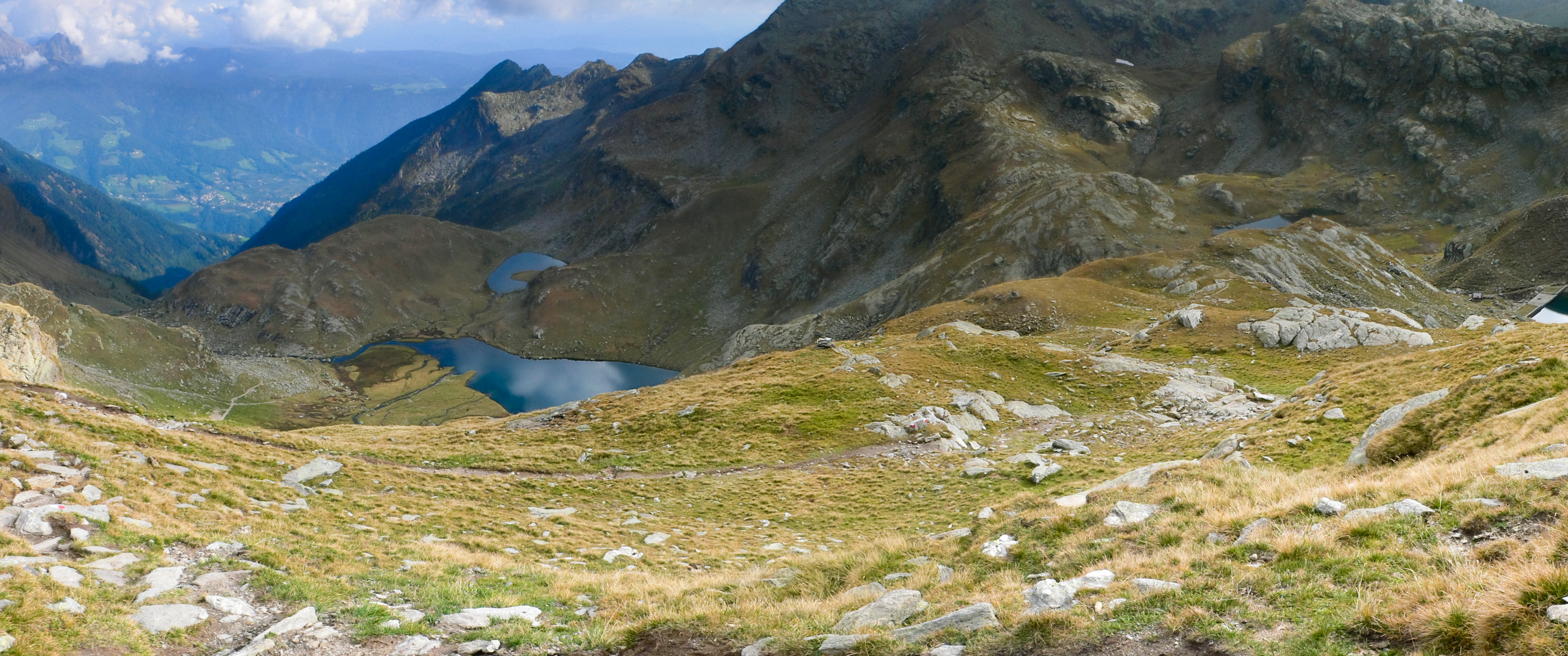
A shortcut would see me back at my bike in a couple of hours, but I was eager to visit the "lake district" up here. Across a barren plateau of enormous granite blocks is the "Milk Pass," giving access to a wonderland of lakes in granite scoops. Hand rails protected the descent to the Milk Lakes, then another descent to the Langsee where I watched the still water ripple with the approach of a wind-bearing cloud and munched the last of my food. I traversed these lakes and more, then climbed to the Spronsorjoch, also known as the "Pass of the Dead."
Looking west from trail #7, near the Tablaner Lakes.
The beautiful Lazinser Valley with the Erenspitz on the right. The massive wall of the Gurglerkamm is behind. My bike is somewhere way down there!
The Milchscharte with the Milk Lakes on the right and the curious Lanamer Bivouac on the left.
My trail goes along the left side of the Langsee, then up the slope behind to the Spronser Joch.
The Langsee and Grünsee in clearing weather.
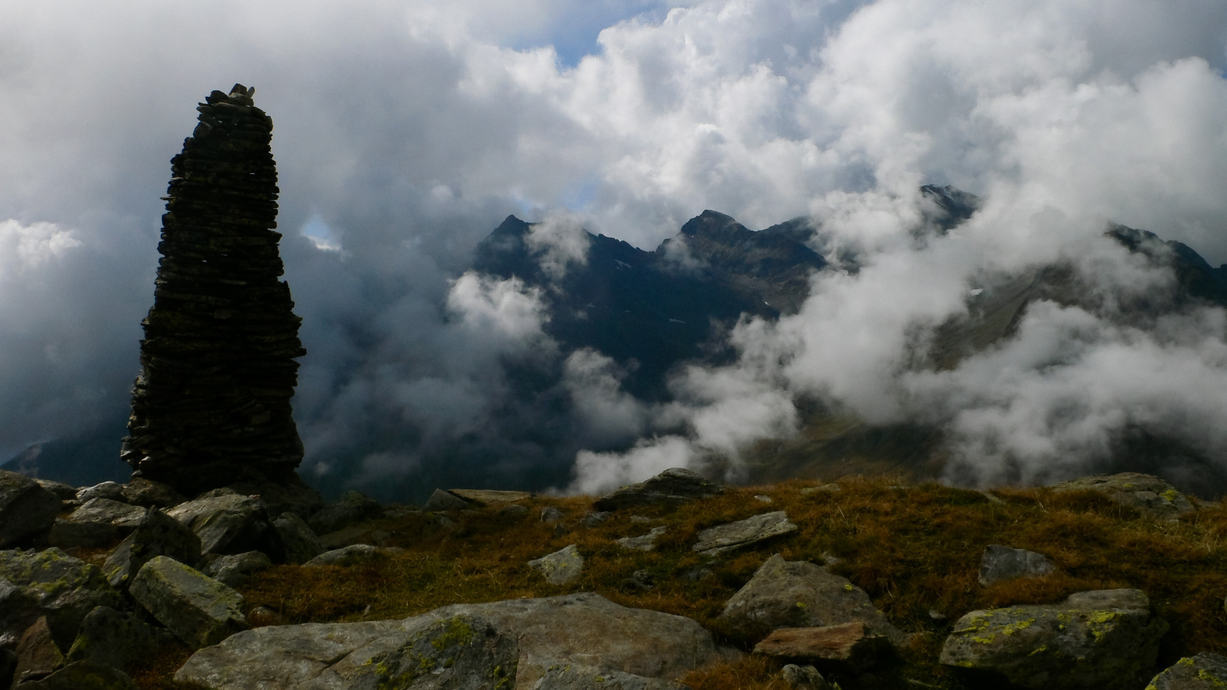
Formerly, residents of Pfelders brought their newborn babies and their dead over this pass every spring for blessings by the bishop in Meran. Meran was the capital of Tyrol before Innsbruck wrested that honor away. It's an amazing journey to contemplate, as the pass is about 3000 feet above Pfelders and 6000 feet above Meran! This place was marked by giant cairns.
The Kesselsee, or "Caldron Lake" in English. This is near the historically interesting Spronsor Joch, or "Pass of the Dead."
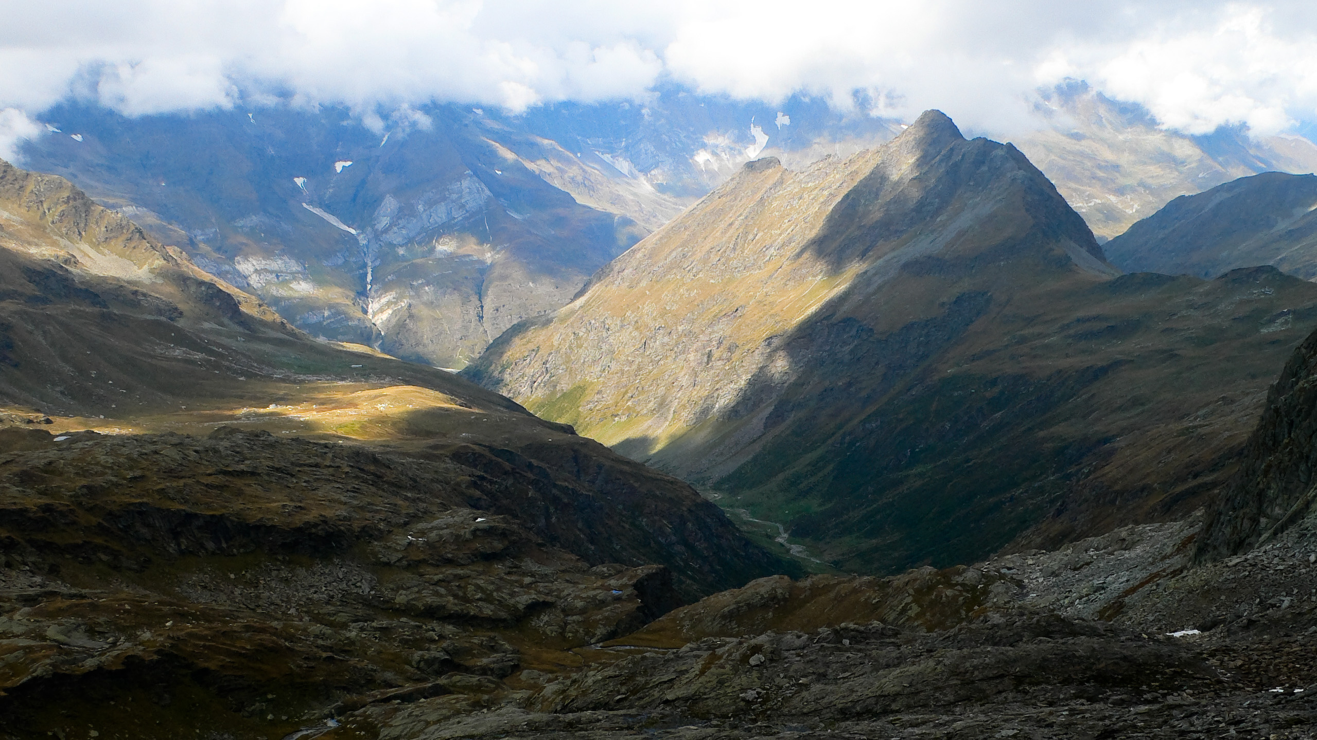
Looking down the valley of the Spronsertal from near the Spronserjoch.
The Kaser Lacke is the blue-green lake below.
Reluctantly I started my final descent, first visiting the Falslijoch just so I could see down into that valley, then turning irretrievably down into a long U-shaped valley heading straight for the ancient dairy farm where I left my bike. At 6 pm I reached it, 10 deliciously speedy minutes later I was at the car.
This lonely place made a strong impression on me. When I need the special kind of peace that only wandering provides, I'll be back.
Basic Itinerary
Day One. Elevation Gain: 2080 m, Loss: 1400 m, Time: 9:20
- Start at Pfelders (Italian name: Plan) (1628 m), parking your car here, which is free.
- Walk or bike the road to Lazinser Alm (1860 m). Leave your bike somewhere around here
- Hike to the Eisjöchlhütte (aka Stettiner Hütte, aka Rifugio Francesco Petrarca) (2875 m)
- Climb the Hochwilde (3480 m) and return the same way
- Go over the Eisjöchl (2895 m), then follow trail 8 south into a basin below the west face of the Hohe Weiße.
- Continue across the basin, passing a lake, then climb to the Johannesschartl at 2854 meters.
- Descent the massive Ziel Valley until reaching the Lodnerhütte at 2259 meters.
Day Two. Elevation Gain: 2030 m, Loss: 2630 m, Time: 10:20
- Climb via trail 9 then 9a to the summit of Roteck (3337 m). Return the same way to the Lodnerhütte.
- Follow trail 7 up to the Halsljoch (2808 m).
- Climb the Lazinser Rötelspitz (3037 m) from there. Descend the same way to the Halsljoch.
- Cross a barren rocky basin on the north slope of Tschigot via trail 7, to the Milchseescharte (2707 m).
- Descend to the Milchsee, then the Langsee.
- Pass the Grünsee on it's right side, and climb via trail 6 (Tiroler Höhenweg) up to the Spronser Joch (2581 m).
- Descend via trail 6 to the Falschnalijöchl (2417 m).
- Descend via trail 42A to the Ziel-Schafhütte (2262 m).
- Descend the whole Lazinser Tal (valley) back to the Lazinser Alm (1860 m).
- If you left your bike there, take it down valley to Pfelders, otherwise walk down the road.