Tristner Harpfnergrat, II+/III-
Friends: Only God!Location: Dristner
Elevation gain: 2200m = 2200m
The Tristner (or Dristner) mountain has always impressed me. I'd been up twice before from Ginzling, and knew it was time to tackle the north ridge, also called the Harpfnergrat (Harpfner Ridge). It would require some exposed scrambling, in fact, climbing to UIAA grade 3- or so (5.0 YDS).
So I got up at 4:30 in the morning yesterday, loaded my cheap mountain bike into the van and drove to Ginzling. Soon I was coasting back down the valley to Mayrhofen on the bike. I stashed it in the woods at the start of the trail, which begins between two concrete garage buildings of a private house (~650 meters). It looks like no one lives there but a lady was airing out a blanket on the upper balcony. I hurried up and away on the stone steps and was soon clearing away the spider webs in the steep forest.
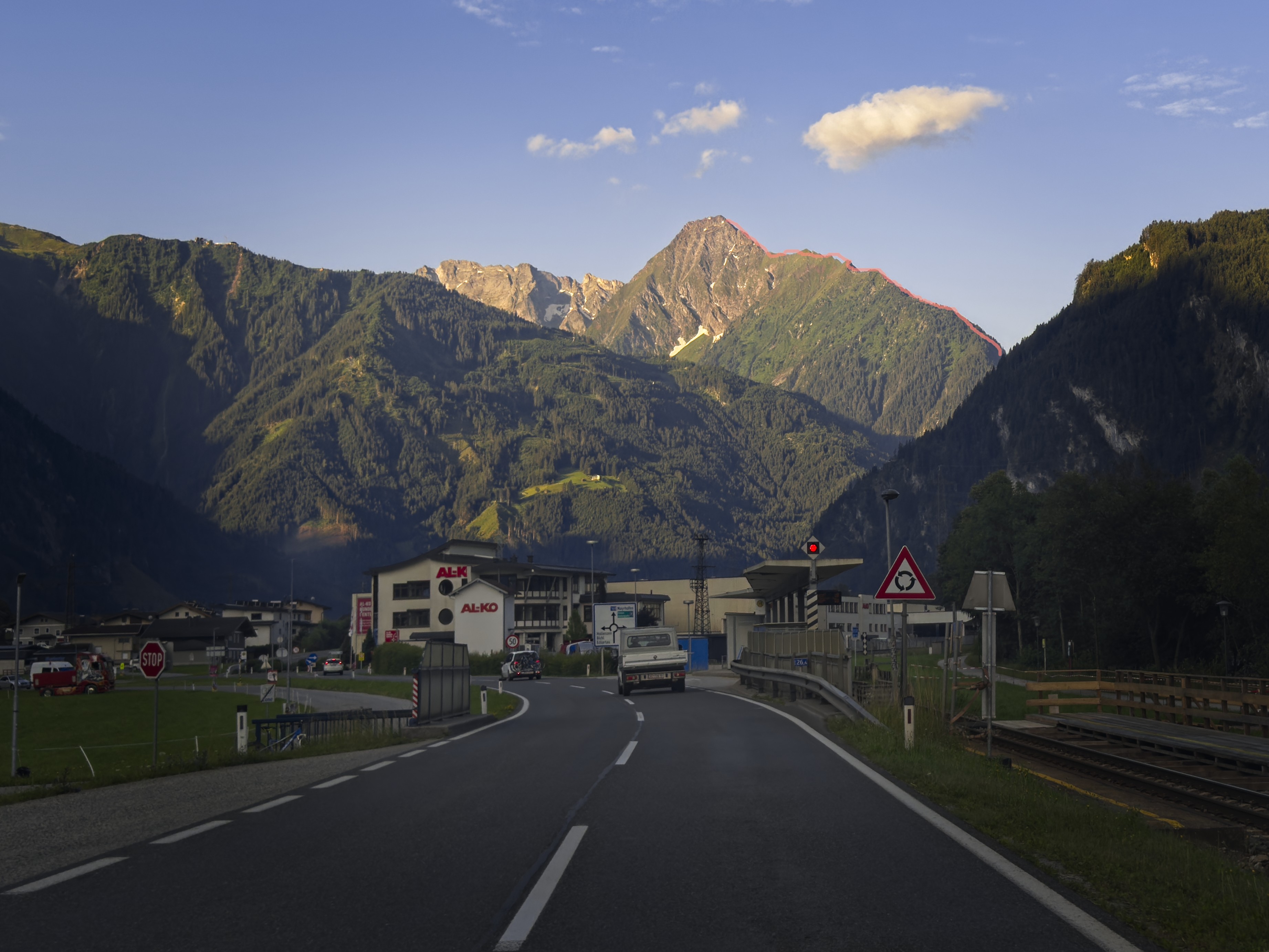
Tristner above Mayrhofen with the Harpfnergrat marked
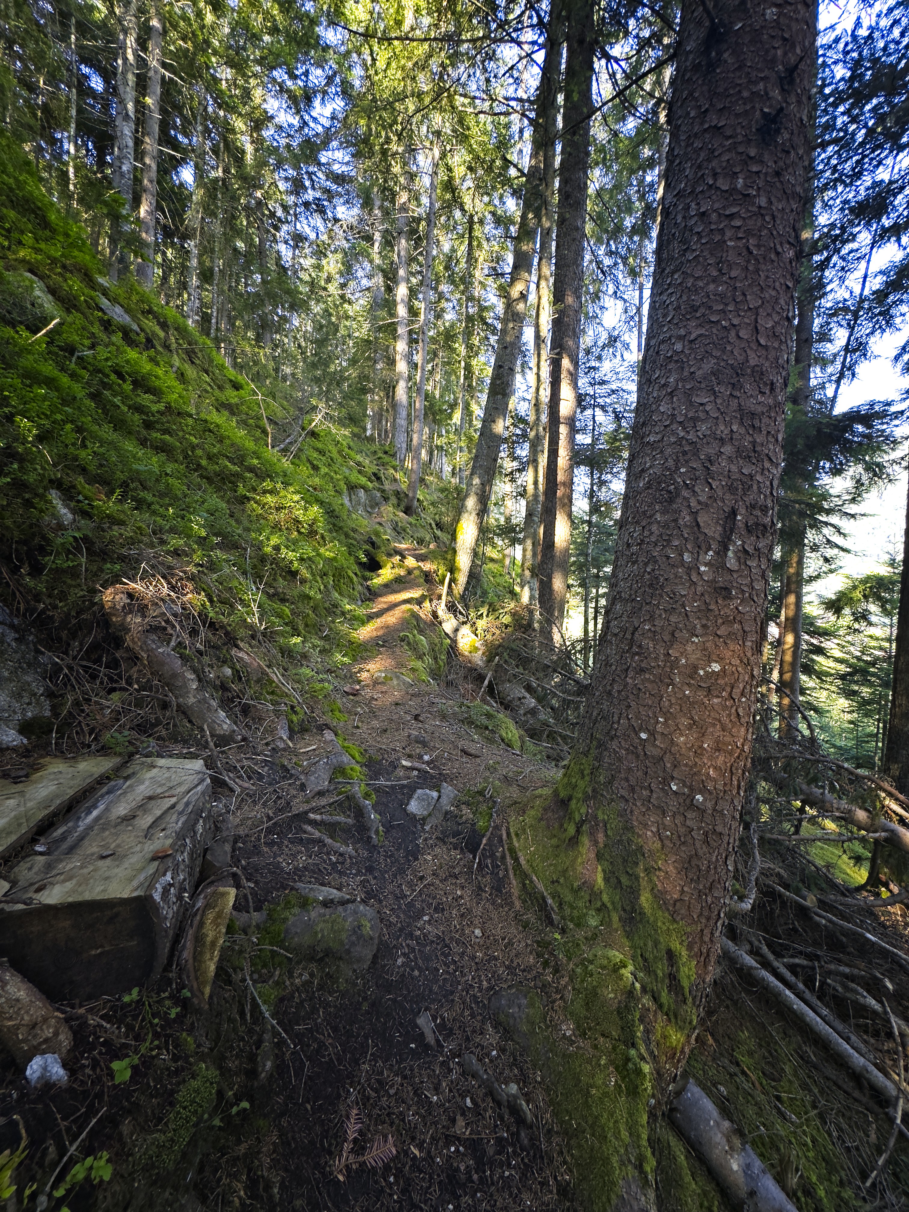
The pleasant forest trail on the ascent
After about 300 meters of elevation gain in the pleasant forest, the trail levels out on the right side of the ridge, making for a saddle with a cabin. The trail continues faintly through a meadow on the ridge up to a cabin with a mechanical lift coming from the valley. Above this, the forest trail is quite beautiful. I kept hearing a booming sound from the valley on the right, thinking there was a quarrying operation. Hours later, I realized it was the wind rolling down the valley from the Stausee and glaciers higher.
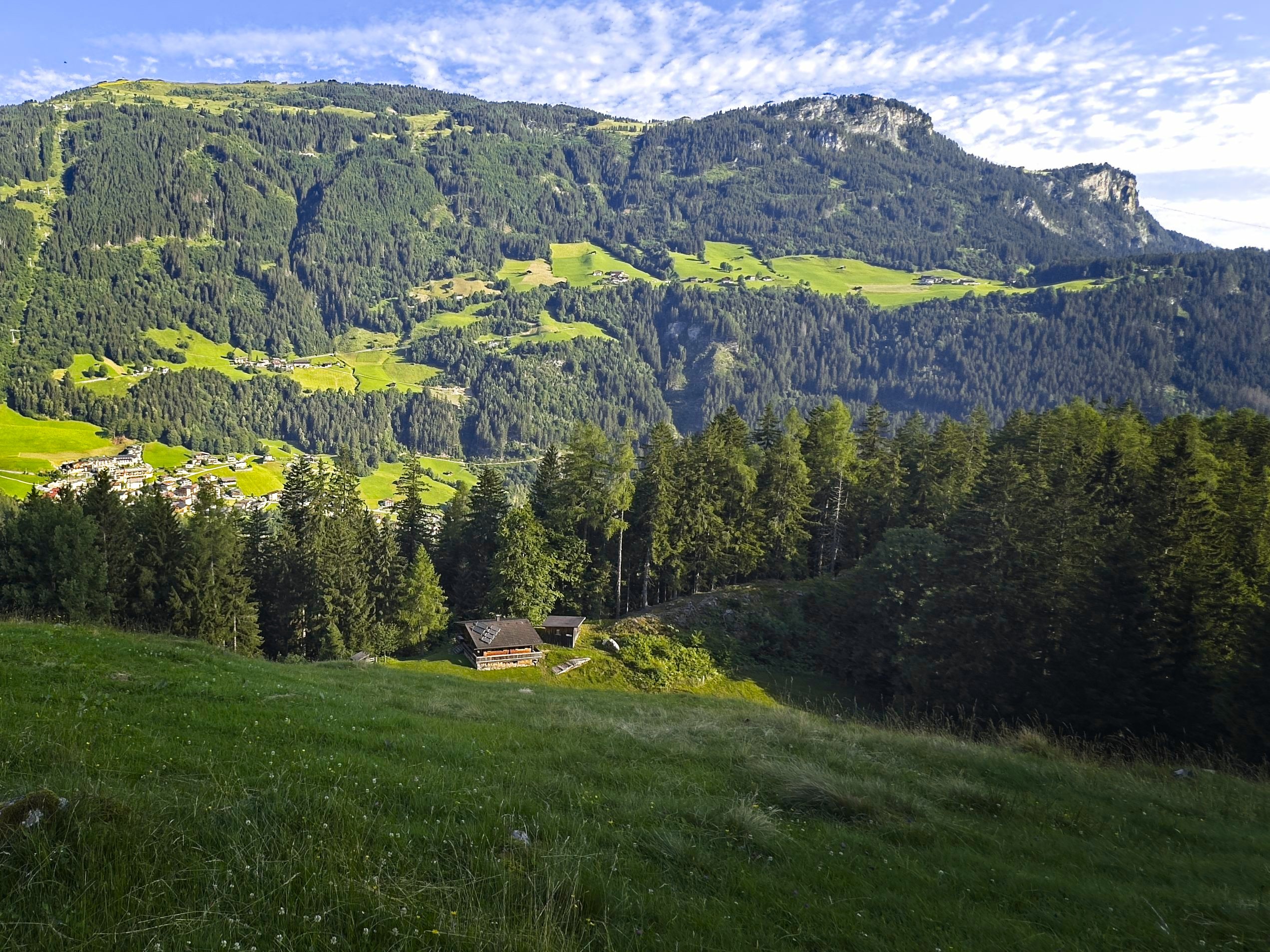
Above the first cabin
Things opened up a bit, and two local guys came by. After a short chat they left me in the dust. One of the men was about 10 years older than I. It was inspiring to see that whatever fitness I have, it could be so much better.
I came to some cabins. One of them had a big water barrel. I refilled some water here from it. I was kind of surprised at this great little community of cabins which can only be reached by a rather punishing climb. The highest of them was at 2000 meters, so a stiff 1400 meter climb from town is required to get there. Respect!
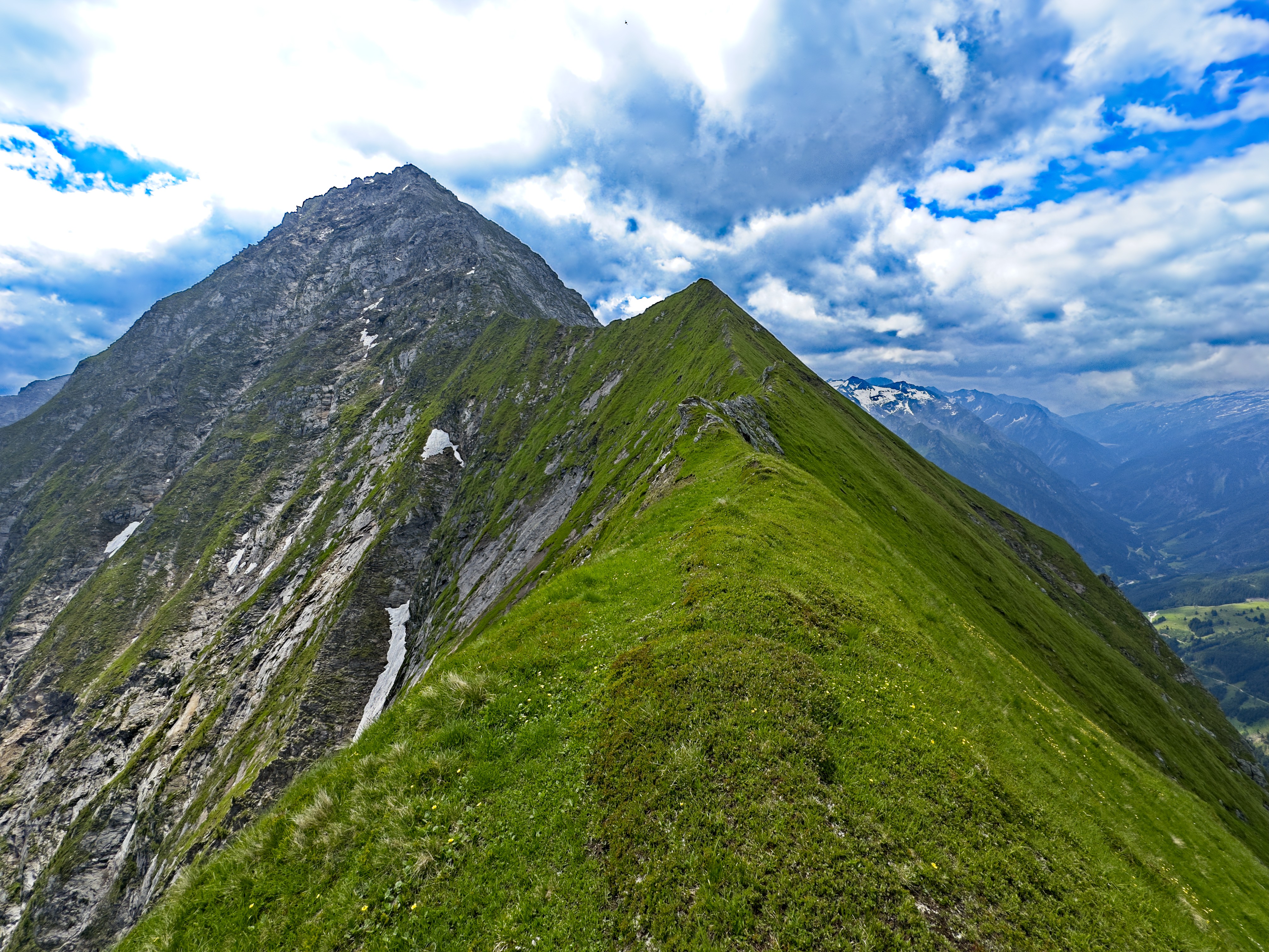
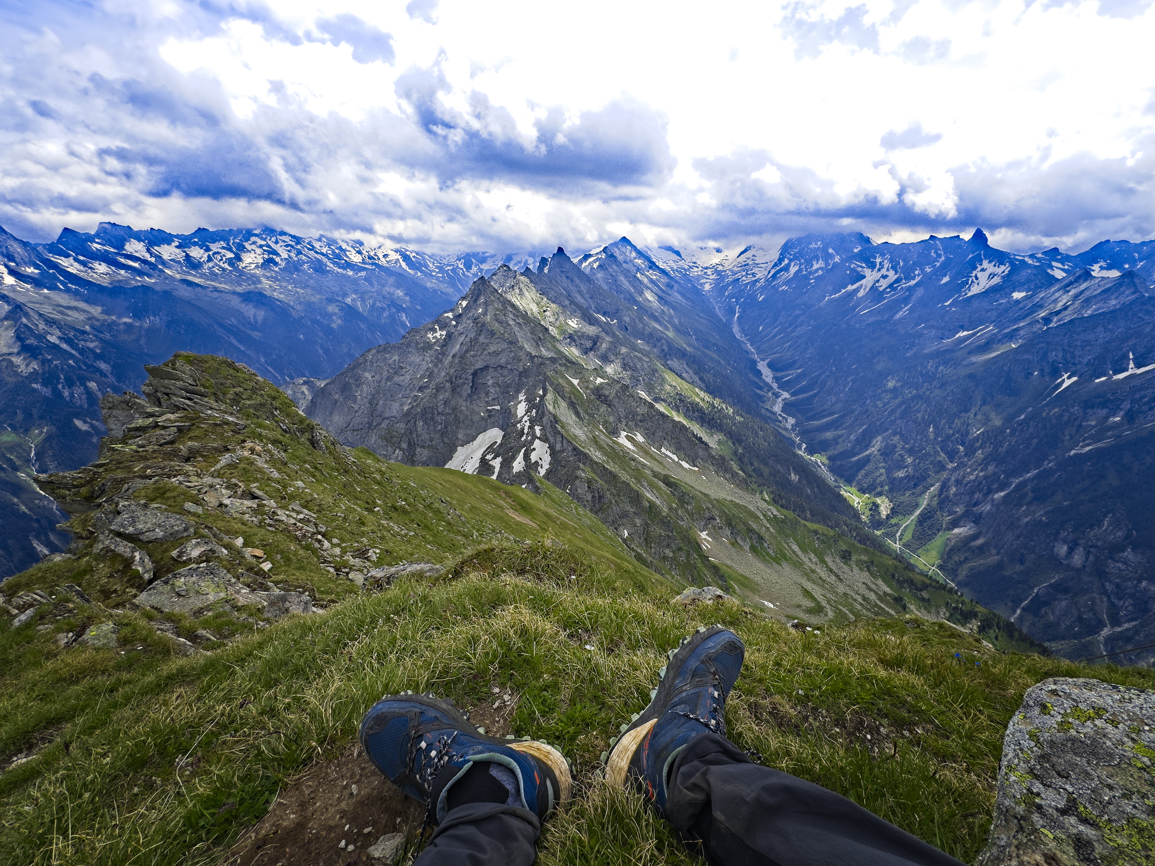
Above that the trail was sometimes faint, though it didn't matter because you just stayed on the ridge, or walked and scrambled up boulderfields. The first climbing moves are at 2220 meters, where you climb a short slab at the bottom left side of a wall. A mix of deep steps in turf, a few small trees to grab, stemming between rock walls get you to the ridge crest above the wall. From here, the incredible view of at least 5 towers on the ridge to the summit is impressive. I gamely set to work. Sometimes a gust of wind required me to sit on the ridge à cheval. At other times I moved forward rapidly because the ridge was an easy, grassy path suspended in the sky.
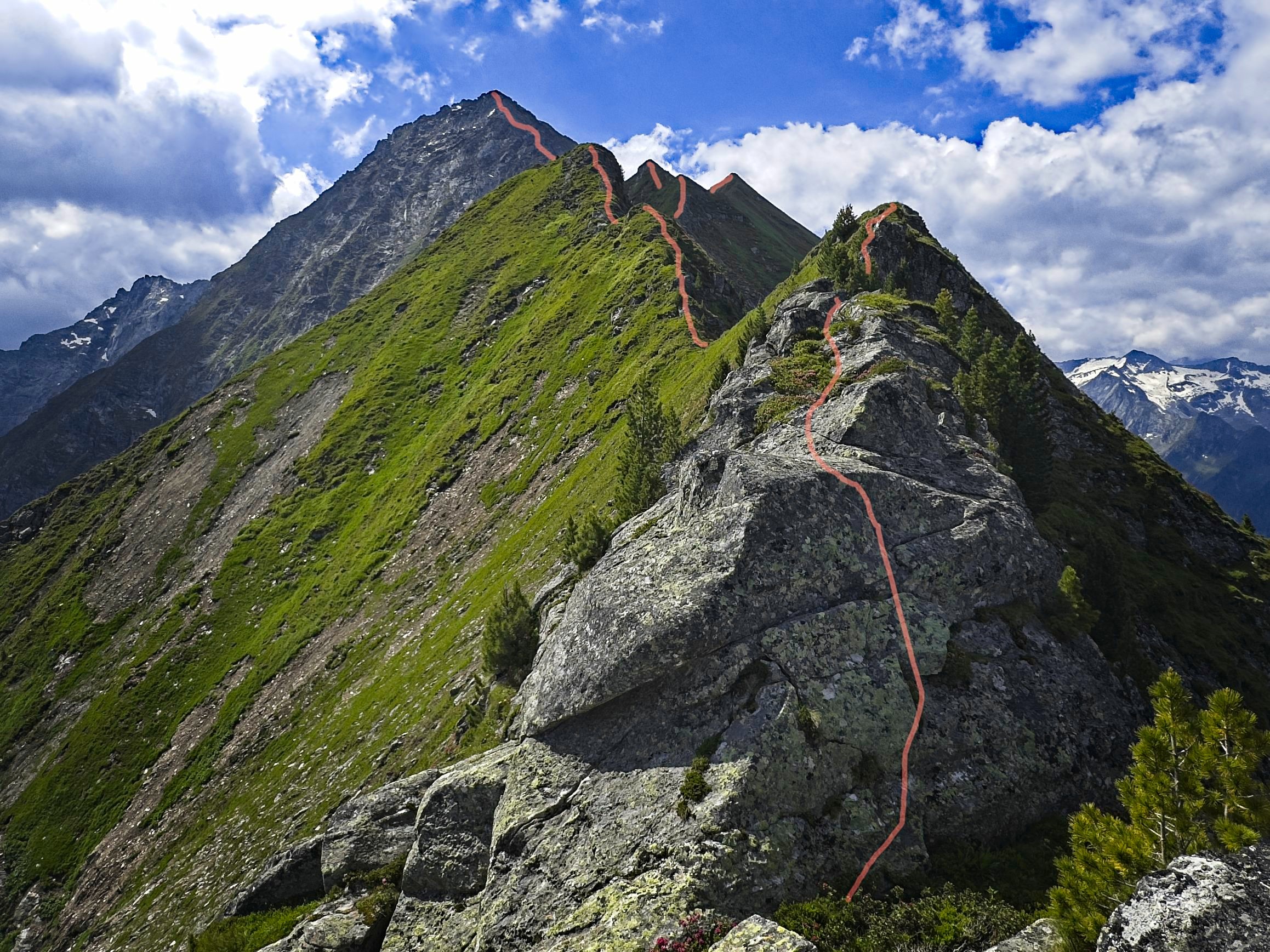
The ridge as seen above the first climbing moves
A pathway suspended
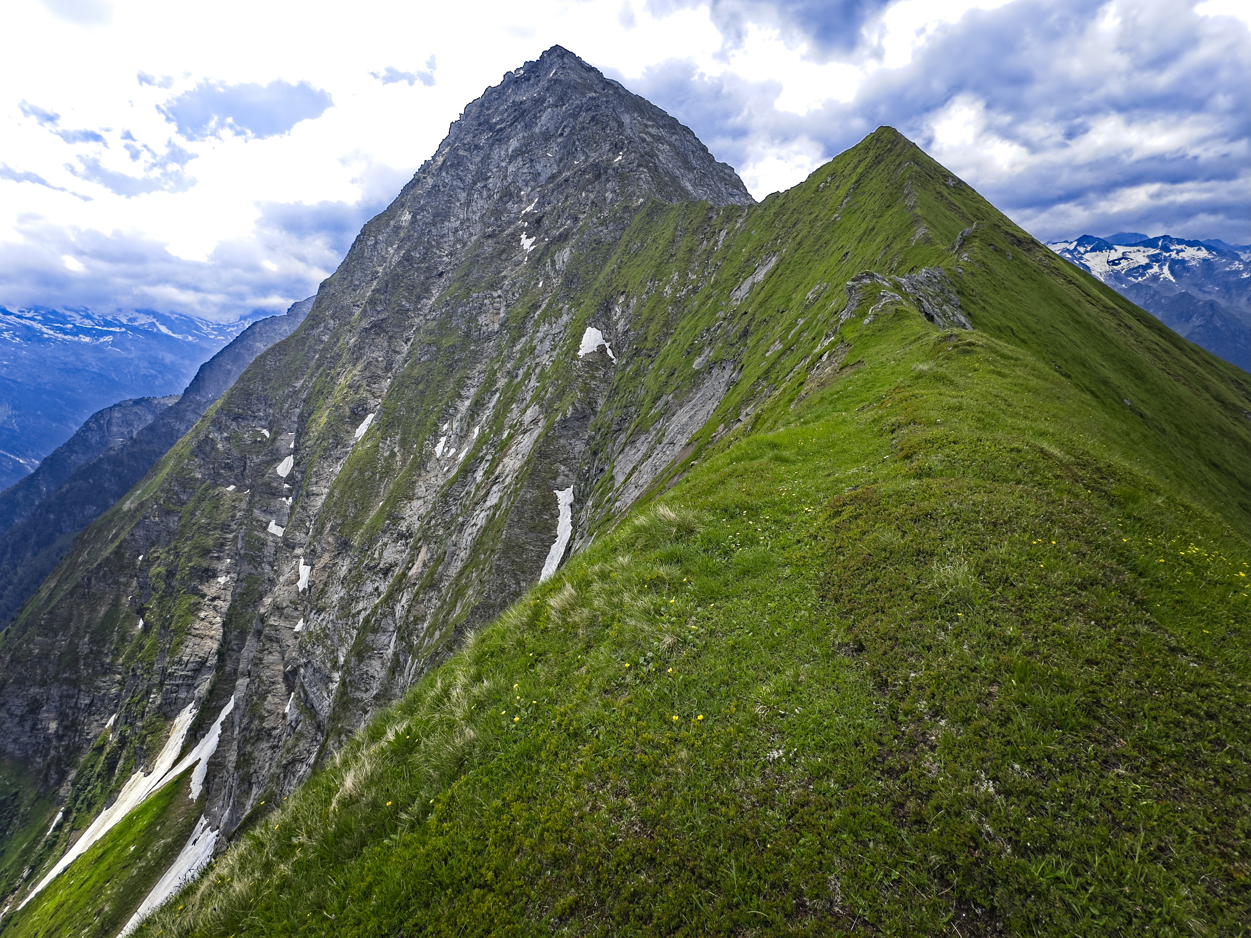
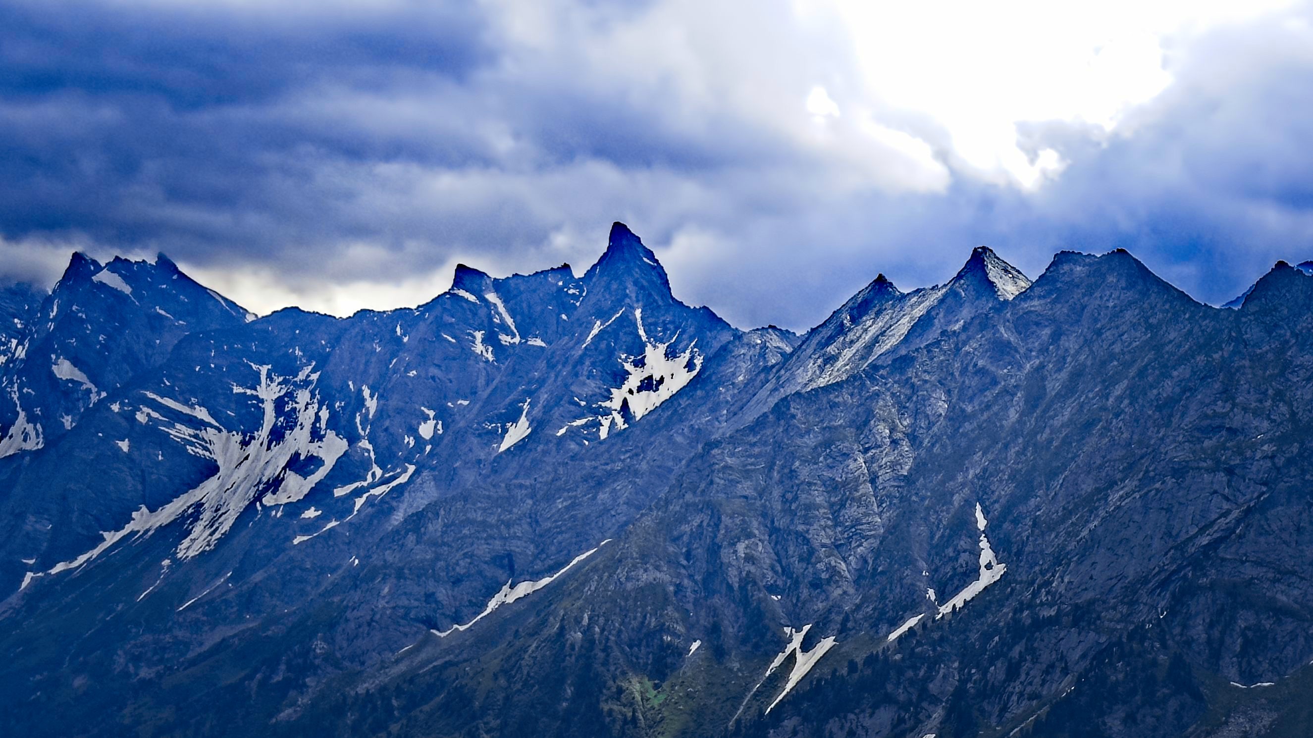
Similar shot, I like the steepness of the Tristner north wall
Paths occasionally went around the side of a tower, but I mostly avoided those because it was alarming to follow one and find yourself well below the crest on a steep, grassy face. Better to make a few moves on granitic shards, after testing them thoroughly.
Finally, I reached the great gray plug of the summit formation. There was interesting climbing in here, little jewels of stemming and liebacking scattered between boulderfields and scruffy terrain. I was on top at 1:15, 5:45 after starting. I'd read some other reports and it seems for most people the ridge takes 4 hours. I am not most people I guess!
Clouds had gathered and thicked over the highest peaks over the last couple of hours, and so I didn't linger too long at the summit. I signed the register, enjoyed the dramatic views and ate the last of my chocolate. Soon I was picking my way down the really, really exposed southern route. It actually felt more tense than the climb up. I also took a wrong turn about 100 meters down and ended up on a faint trail above impossible green slopes - how can they be so steep? That was a nerve-wracking 5 minutes (should have just gone back up).
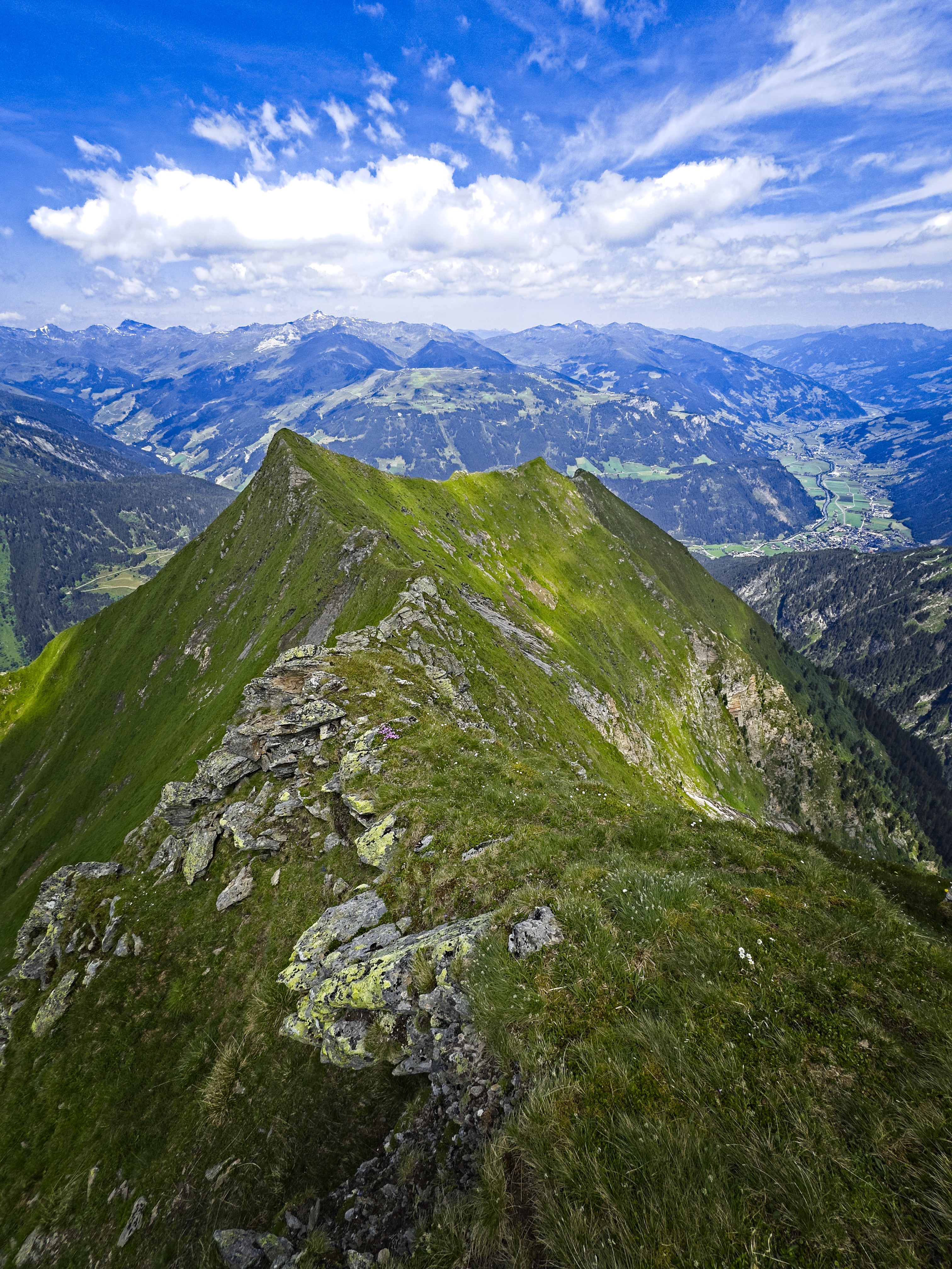
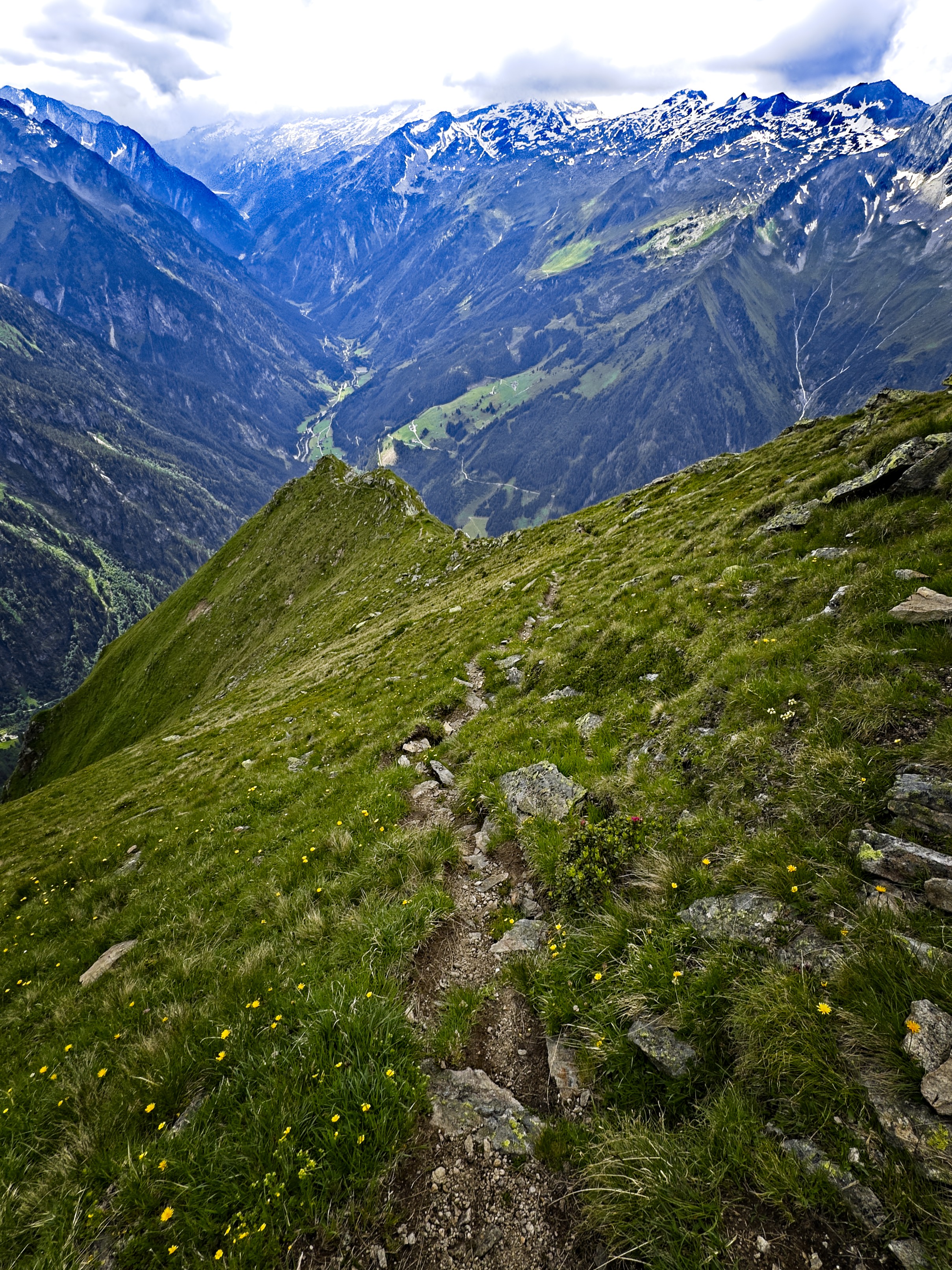
Looking down on the ridge
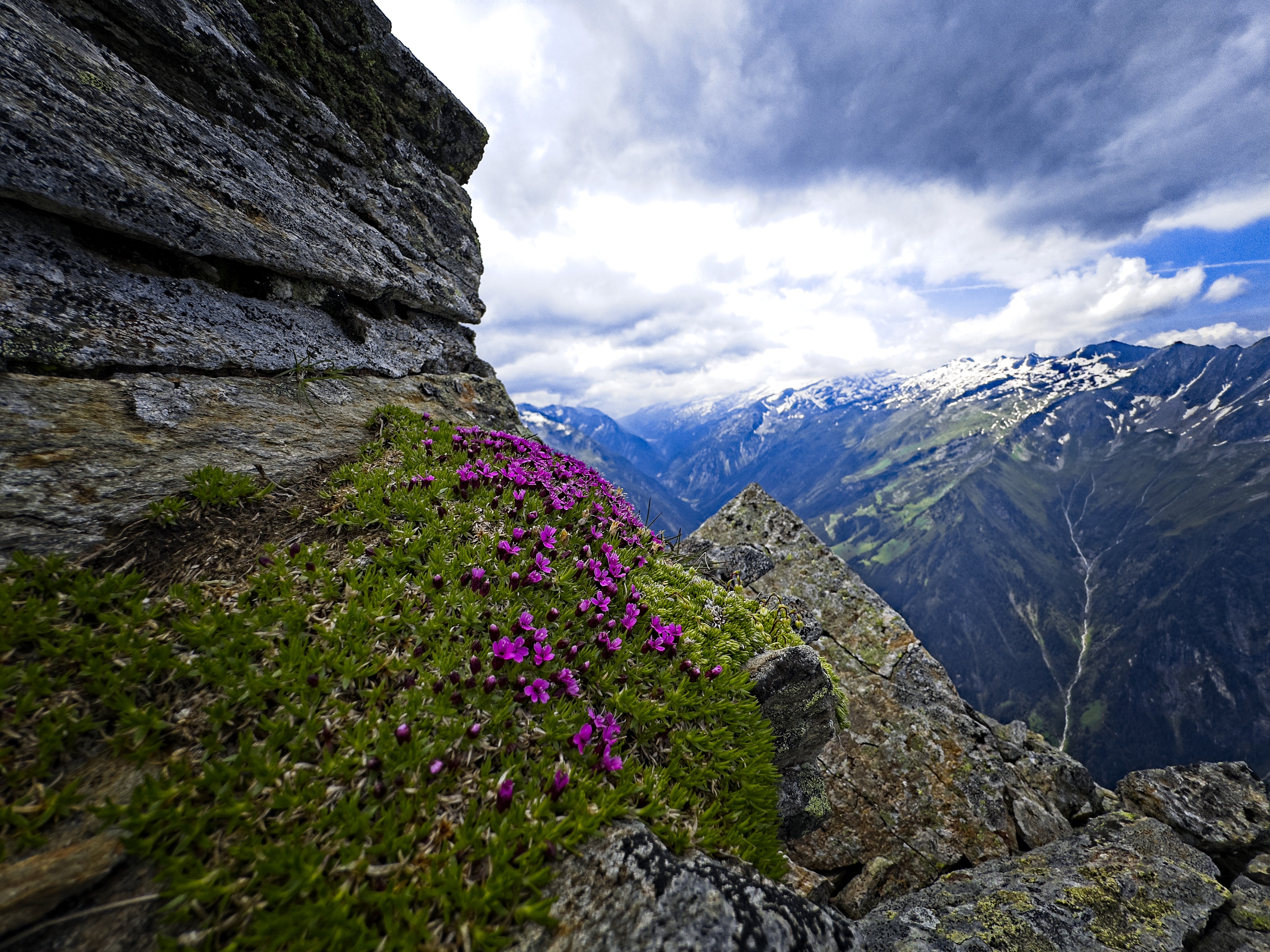
Flowers near the summit
You simply cannot relax on the upper 500 meters of this trail. A slip is unthinkable. I kind of think that with a bit of effort to build the trail, the northern route would actually be easier and safer!
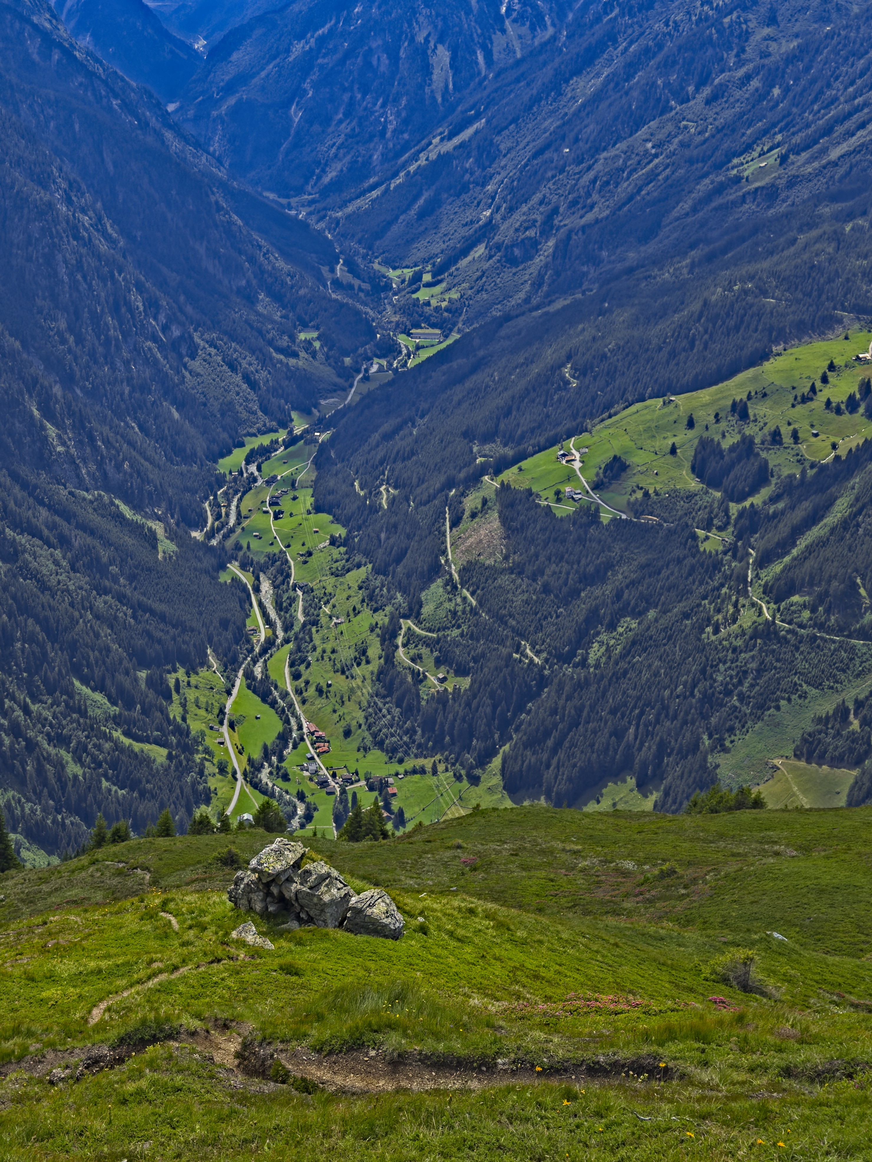
I got some water at the cabin and rested a good while, actually laying down and quasi-napping. This made the last 800 meters of forest descent more enjoyable. I find that to be a really beautiful trail. It's rather overloaded with sticks and pinecones at the moment though, I hope a fella with a broom comes along!
On top
The unsettling upper trail down to Ginzling
Very happy for this climb, because on the drive to Mayrhofen, the ridge looms in the distance as a challenge. It's an important and challenging feature of this country, and whether you hike it or not, it waits for you and wants you to know it better. Or so it seems to me. Thank you Tristner for a great day. Thank you God for guiding my steps!
The Zsigmondyspitze in the picture is the "Matterhorn of the Zillertal"
A long ways down to go...