Bettelwurf and Stempeljochspitze
Friends: Only God!Location: Großer Bettelwurf, Kleine Stempeljochspitze
Elevation gain: 3700m = 2000m + 1700m
Day One
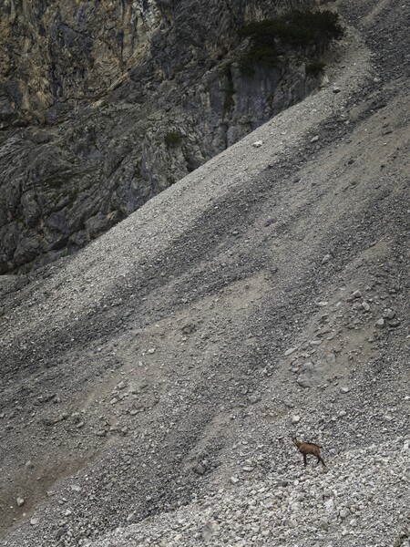
Weather was unsettled, but I thought that if I got an early start I could do a big hike. Sleeping in Mantra, I awoke and was hiking by 7 am from the parking lot at the upper end of Absam. I enjoyed the walk up along the raging river, and then across and into the Gamsgufel. Gämse scattered in a relaxed way as I approached, going further up or downvalley.
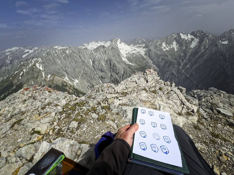
On the summit, where I made a little artwork from the stamp in the box
I found a story behind the name "Bettelwurf," it is quite interesting! Here is my rough translation from the German on the Hall-Wattens Tourism web site:
Pious men brought nuns to the monastery at St. Magdalena, nestled under steep walls of the Hall Valley. But the nuns were not all capable of being moved by God. Some were resentful and querulous.
One day, a poor worker from the salt mine up the valley came to the monastery gate and begged for alms for his hungry children. Scowling, the nun guarding the gate threw a piece of stone-hard bread at him. The poor man, now angry, hollered: "This junk, you can eat yourself, you tightwad!" And with a powerful movement, indicating the depth of his anger, he threw the bread against the rock wall by the gate.
However, whether it is hard or soft, bread is a gift from God, and should be treated with care. The scowling nun knew at least that much, and she was angry. She cried: "You'll pay for that! You will find no peace in the grave. Your spirit will find no place to sleep, and you must wander up and down this valley for eternity!"
And so it came to be. The man was never seen again. Invisible now, he was a fluttering presence amid the rocks of the Halltal. In winter, his unsettled pacing and frustrated bursts of energy loosed avalanches of soil and boulders. In summer, great shards of rock fell from the heights. On warm days when the Föhn wind whistled through the valley, his cries, alternately pitiful and enraged were heard echoing down from the high cliffs.
But the scowling nun was also punished. In 1670, an earthquate damaged the monestary buildings, and 19 years later they were completely destroyed by another earthquate. The loose and steep rock wall, against which the poor worker threw the hard bread, became known to the people as the "Bettelwurf."
I marvelled at the trail, so steep and effective. On this cloudy, misty morning, it was easy to travel through the vast latschen fields on the way to the Bettelwurfhütte. But I wanted to climb the peak before I visited, so I turned off to the right and made my way up a steep trail to the saddle on the ridge coming down from the summit, here advertised with a sign for the tourist population as the "Eisengattergrat" (Ridge of Iron, or maybe the Iron Gate Ridge).
I met a couple coming down who had been turned around by some mandatory snowfield above. The weather was holding, though dark clouds were visible in the west over Innsbruck. I reached and carefully crossed the snow, then continued another 200 meters up to the summit without further snow difficulties. The views were subdued because of a general haze or thickness in the air. But I was happy to be there anyway.
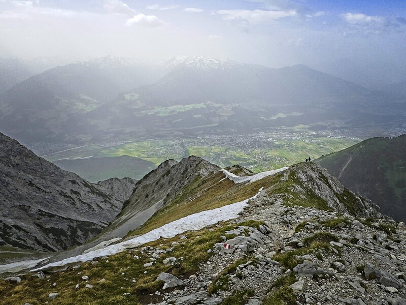
Two hikers descending the Eisengattergrat
Coming down, I turned off to visit the hut and drink a beer and eat a slice of banana cake. A nice man came up from town with a friendly dog. This dog was great, he would nudge you if you stopped petting him!
I also spoke with a woman from Montreal, doing a multi-day hike here with her husband, taking a nap inside in the hut.
On the way down, the man and his dog caught me resting at the Gamsgufel bench under the overhanging "Bettel." He gave me some water and his dog gave me some nudges when my energy flagged in petting him assidiously.
2000 meters up/down.
I decided to spend the night in Thaur, and do another hike the next day.
Day Two
After a night of strong rain and hail, I was well-rested if a bit sore.
I parked at the Thauer Alm / Haselbergsteig Parking Lot, and hiked steeeply up trails that occasionally intersected a road. I was avoiding music and podcasts so I could keep the lovely feeling of God in the So Hum mantra. I've tried doing this for years, but it is only recently that I can sustain it through a long period of exercise. I finally gave in to the lower mind at the end of the day slightly above the Thauer Alm Hütte, and listened to a podcast. It is always a mistake to do so! Because I can't easily get the feeling back that day due to general exhaustion.
Oh well, live and learn. But I get ahead of myself.
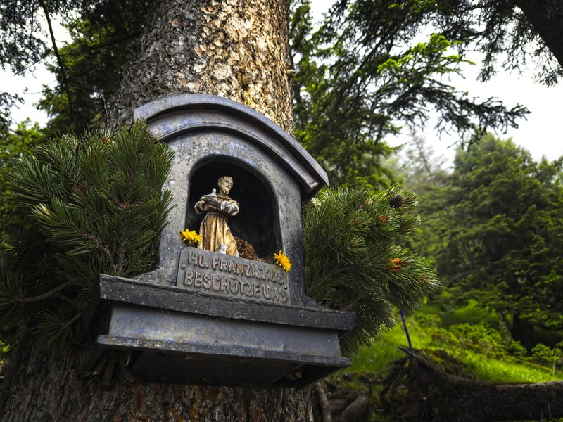
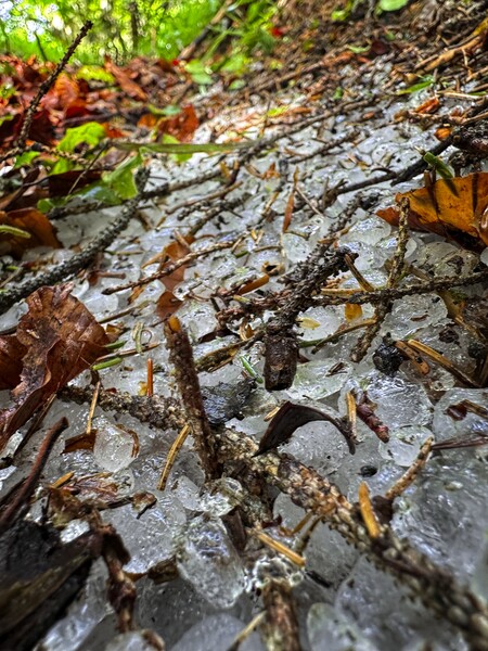
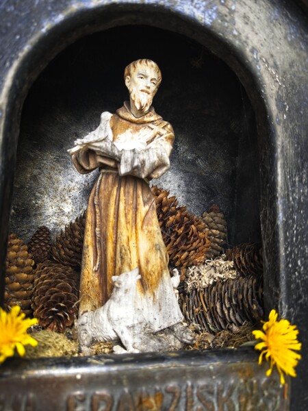
The trail is steep, steep, steep! I passed by a hunter's cabin at 1450 meters, finding wonderful balls of ice in the forest, leftovers from the hail of the night before. I continued above the Miaswald, first admiring a charming shrine to Saint Francis. Then I reached a bench at the Hahle Wandl, charmingly set below a steep but rather inviting wall.
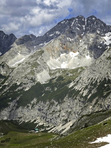
The Pfeishütte and the powerful Sonntagkarspitze
Above all this, the final climb to the Kreuzjöchl was rather intimidating. Very steep, with a hand line that didn't inspire much confidence because one of the "stempels" had fallen out of the rock. The view at the Kreuzjöchl was fantastic. Suddenly I was in a different world, admiring peaks of the Gleirschtal across to the north. I walked in a dream towards the Stempeljoch, happy that my summit remained free of slowly gathering clouds.
First I had to cross a long, steep snowfield with no tracks. It probably took twenty minutes to get across, patiently kicking each step, at least five kicks per step in the hard snow. At least it would be quicker on the way back now that the steps are in place!
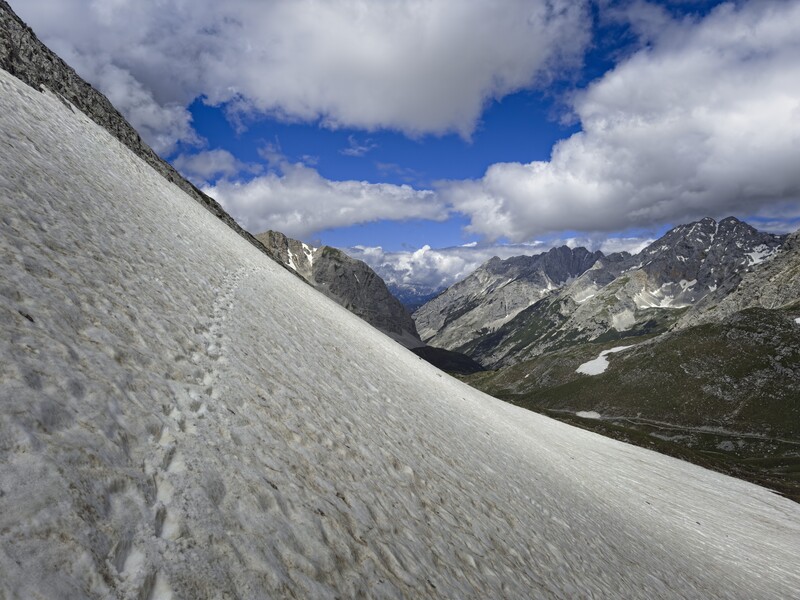
My snowfield on the north side of the Thaurer Jochspitze
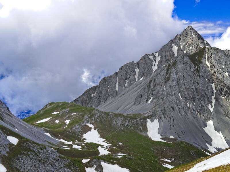
The Kreuzjöchl and the impressive Rumer Spitze
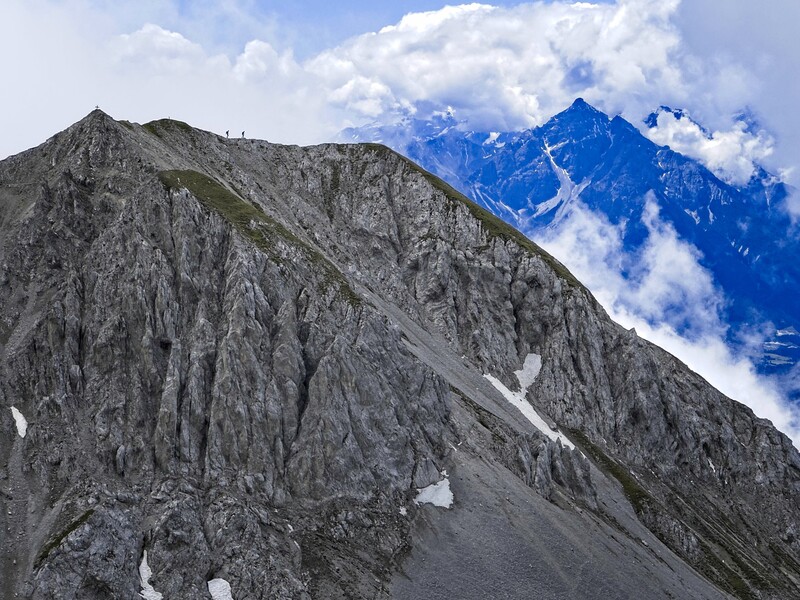
Two hikers on the Thaurer Jochspitze
High on the mountain, I crossed an interesting snowfield where a tunnel in the snow made it easier to return. I also saw some ridiculous cornices!
I hung out, looking down into the Gleirschtal. What a great place. I saw two hikers on the ridge top of the Thaurer Jochspitze, which looked fun. It would be great to come back here more often.
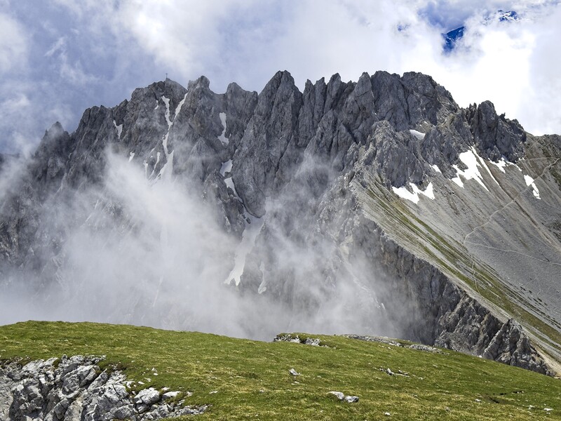
The jagged ridge between the Lattenspitze and the Pfeiserspitze
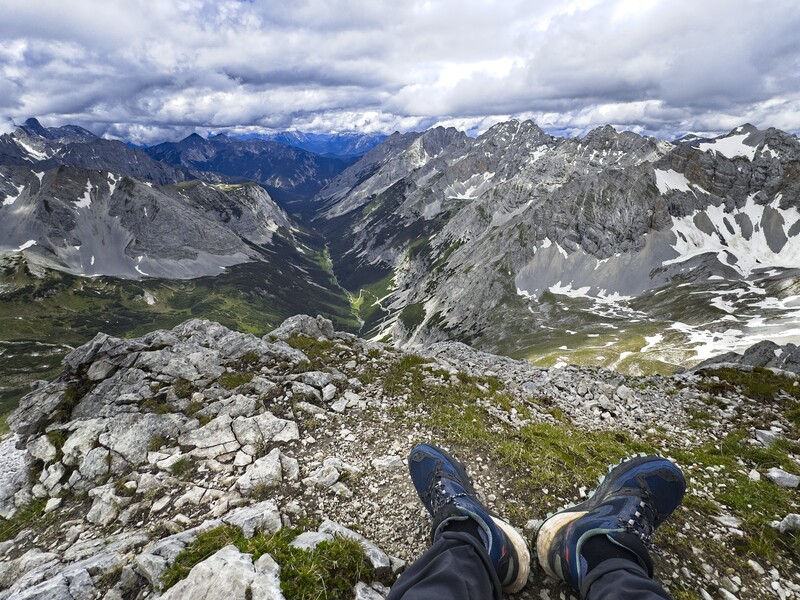
The Gleirschtal from the Kleine Stempeljochspitze summit

A "pano-rama" from the same place
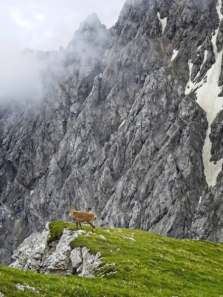
A Gämse high on the Kleine Stempeljochspitze
I made it down without trouble, then spent my 5 euros on a Radler at the Alm. It cost 4.20, and I gave 80 cents as tip. From there I continued down on a mix of road and trail...road when I wanted to relax and look around, trail when I was ready to bend to the task again and move steeply down. 1700 meters up/down.
A few more pics...
