Mount Idaho
Friends: SeanLocation: Mount Idaho
Elevation gain: 1630m = 1630m
A little video of the eventful day:
Sean joined me for a climb of Mount Idaho. This would be my 4th 12,000-er summit in the state, and I'm getting excited about the idea of climbing all of them this year. I think I can do that! Then it's on to the 11,000-ers, though I expect that to take a few years!
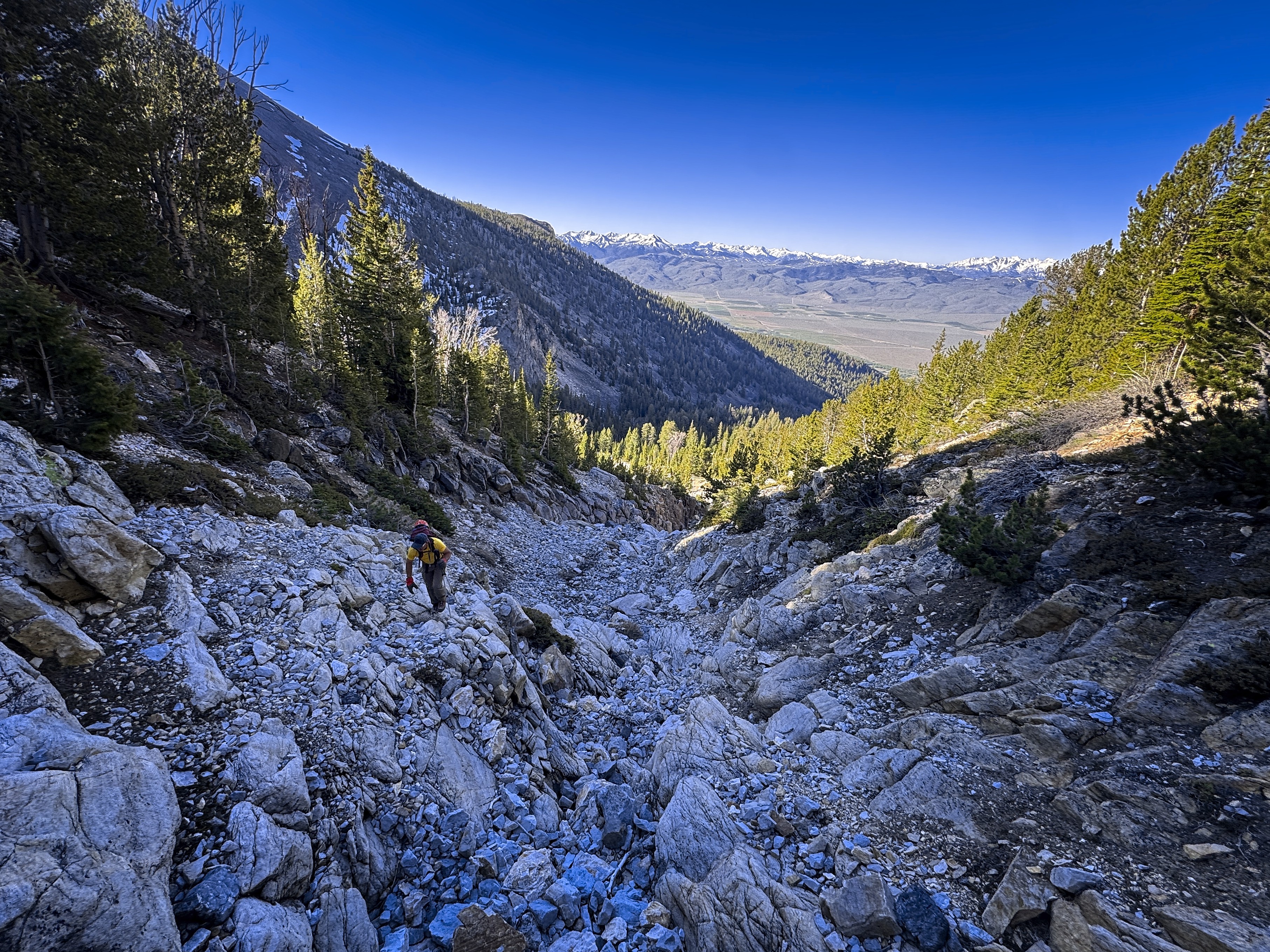
We are making for a point on the crest below the rock towers on the right.
Mt. Morrison is up on the left
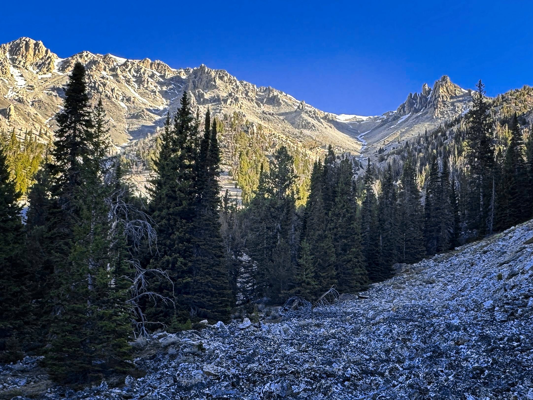
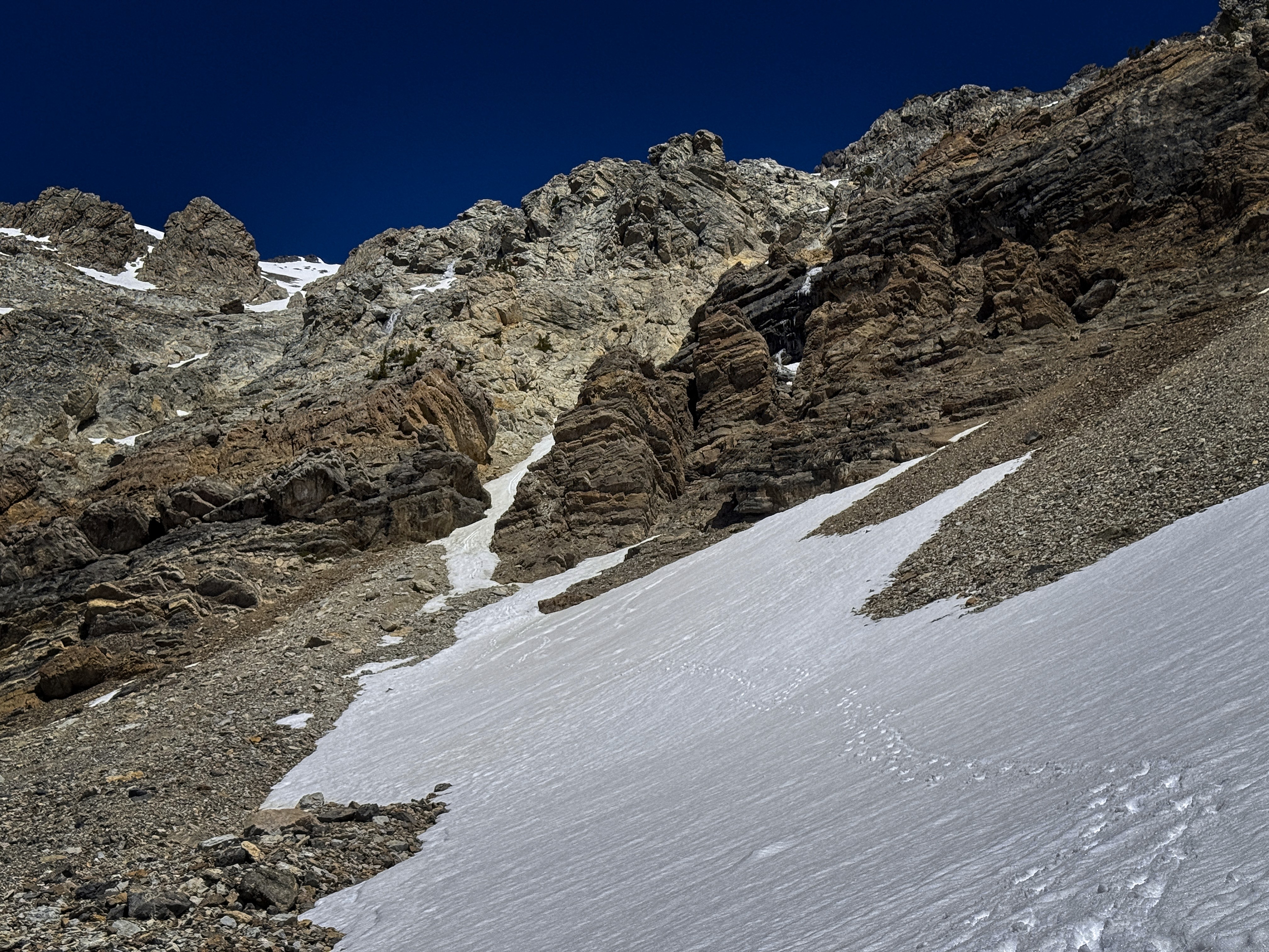
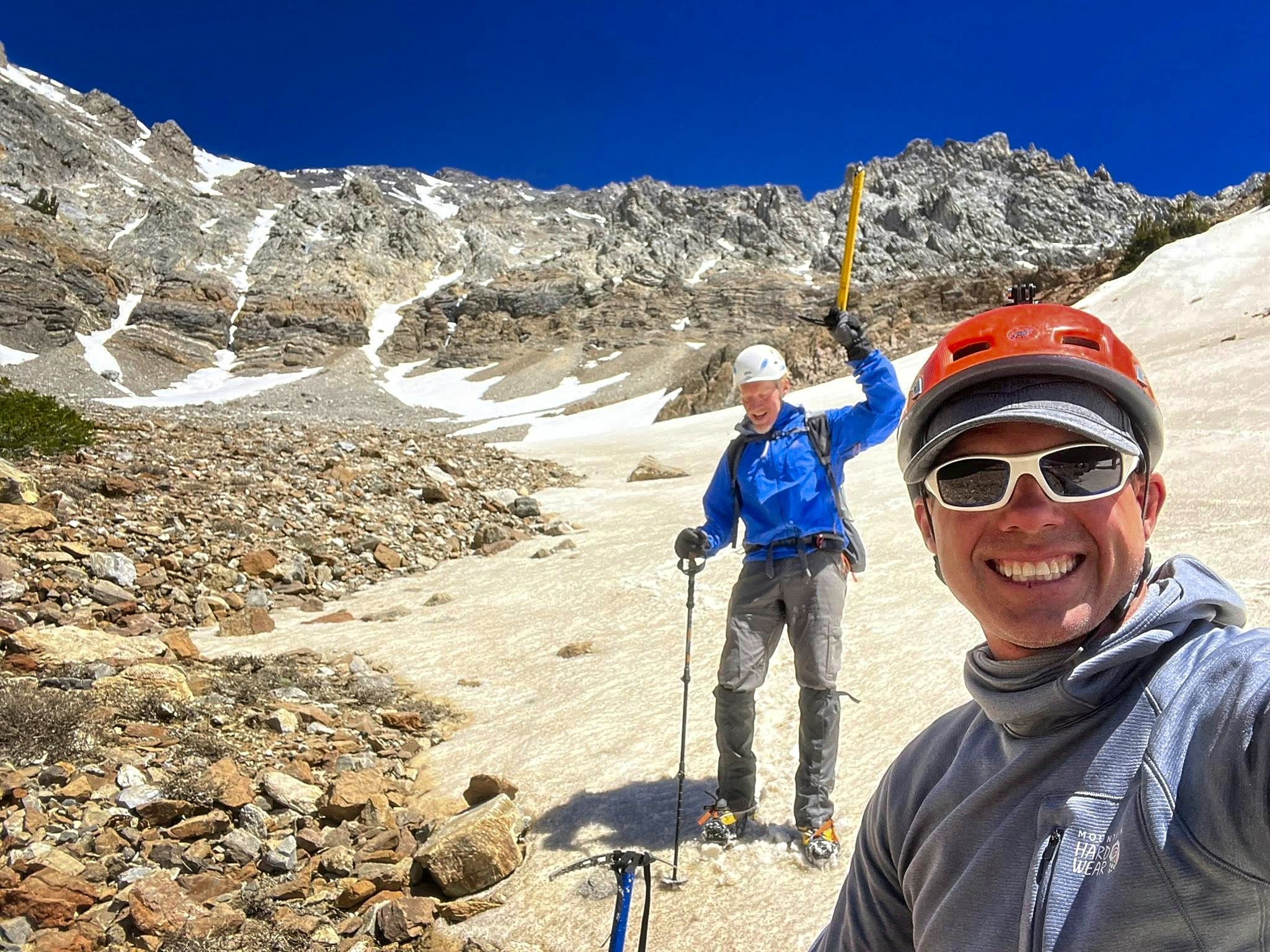
In the ascent stream gully
We hiked up the steep trail through sagebrush and into forest along Elkhorn Creek. I got really absorbed in an argument about some aspect of leftism that really bugged me. Leftists appeal to the ego by throwing out all the common-sense knowledge that is handed down, and replacing it with a host of German and French theories that purport to show the power behind the throne. The new holder of that knowledge now feels special and becomes alienated from his or her parents and community. Here, he or she could go two ways. One way is to hate the "4 olds" (see the Chinese Cultural Revolution for the history of that phrase), and try to destroy them. The other is to "minister" to them, trying to teach and uplift them into the new theories. Of course this is a hopeless task, and both roads lead to lonely embitterment. And THAT end state is actually the point of the whole transformation: the increase in the number of blackened and lonely hearts is what leftists believe will cause the power structures to collapse. If one thinks "never let a crisis go to waste," then one must create the crisis. The left leads its people astray and abandons them. The Pied Piper mythos comes to mind.
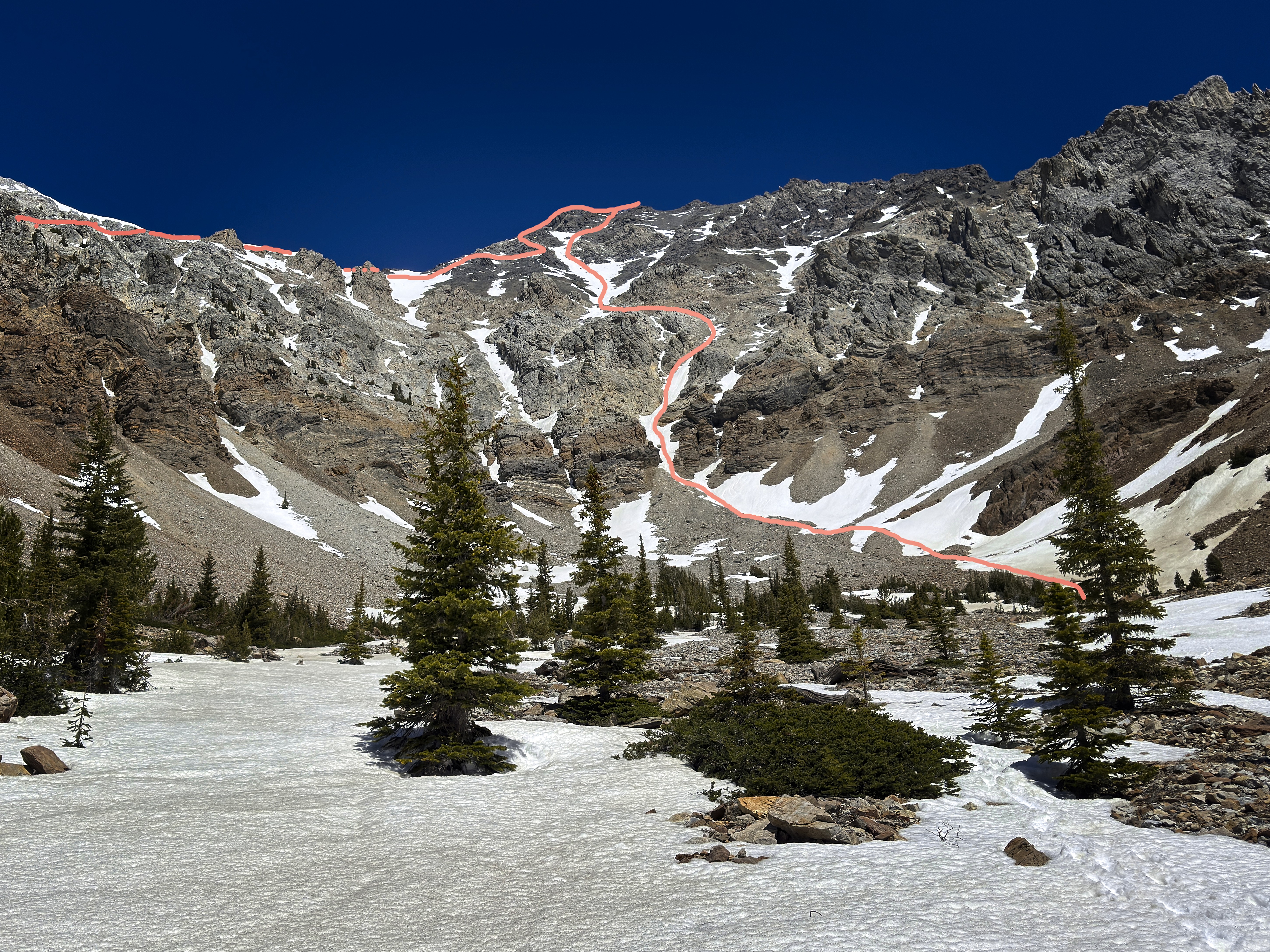
Hmpf! Anyway...by thinking about that sad situation though, we'd covered 1000 vertical feet without any actual effort...I'd just floated upward on my sad, but still interesting thoughts. I didn't notice that I'd been following cairns that led me incorrectly too high on a hillside. Sean, with better instincts, was a bit below, following an inner compass. We corrected our course, going to the left side of a buttress and getting a view of a high, sere ridge far above. We followed a stream bed until it was steep enough to use hands, then Sean led us out to the right side, remembering that he'd climbed a cliff here years ago. Indeed, we found the cliff, unusually made of granite. A right-leaning chimney got us above it to a slope of scrubby trees and scree, then to a saddle where an easy traverse would get us to the ridge crest below our peak.
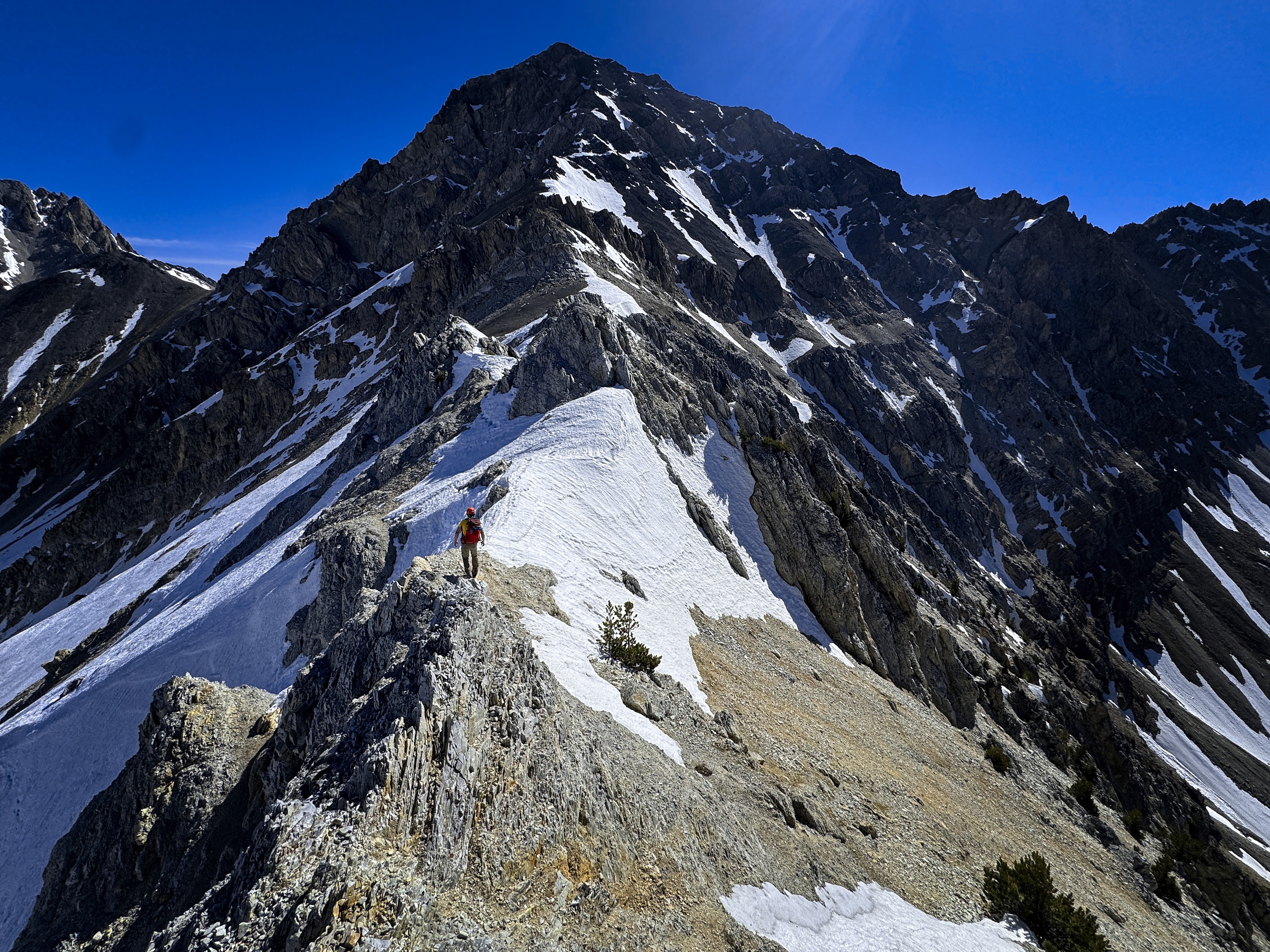
On the crest, below the rightward snow traverse, which is visible
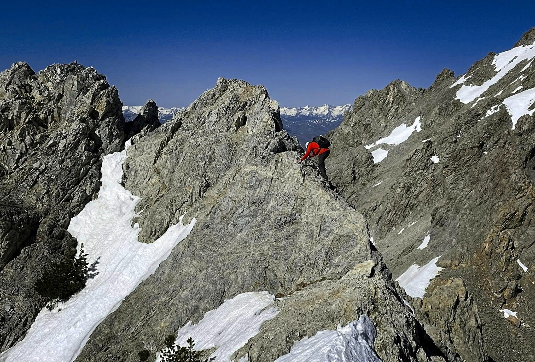
First we had some food, and I got the snow boots on. And soon we were scrambling on the ridge-crest, then crunching up snowfields on the right side. Sean pointed out a rightward snow-traverse. After that, we took an exit up and left to the crest again. From here the rest of the climb to the summit featured fun 3rd and 4th class rock steps. Sean had a GoPro on his helmet, which documented his preference for shady open-books and chimneys on the left side of the crest which was a bit steeper. I got into the spirit, and we stayed on the crest as much as possible, enjoying our high boulder garden.
Michael on the ridge crest
Enjoying some snow climbing
Getting around a tower on snow
Enjoying some rock climbing
Then we were on top! Good views over to Borah in the north and Leatherman in the South. We signed the register and started down, now intent on going down the south face if it looked like we could stay on snow. I thought I saw a line that worked. First we descended 200 feet of scree, then got onto the steep snowfield we'd come up. Annoyingly, the snow was still too frozen to feel good about facing out and plunge-stepping or glissading down. We alternated between facing in and sometimes descending in traversing French-technique style. We passed the last opportunity to traverse over to the ridge crest and committed to the line. Sean got ahead and I hollered down that we needed to get past a discontinuity in the snow by traversing to the left. He went over a little crest and did this. I arrived there, then followed his tracks through scree and snow-patch down into the next gully over (skier's left). Soon there was another snowfield, and it looked like we could reach the valley floor with it. Sean waited a bit and filmed my tedious descent for a while. In fact, one boot was a bit too loose, and I was flexing a muscle in my foot enough that it hurt the next day. In the end, it was about 1500 feet of front-pointing descent!
Sean takes a rest on the summit
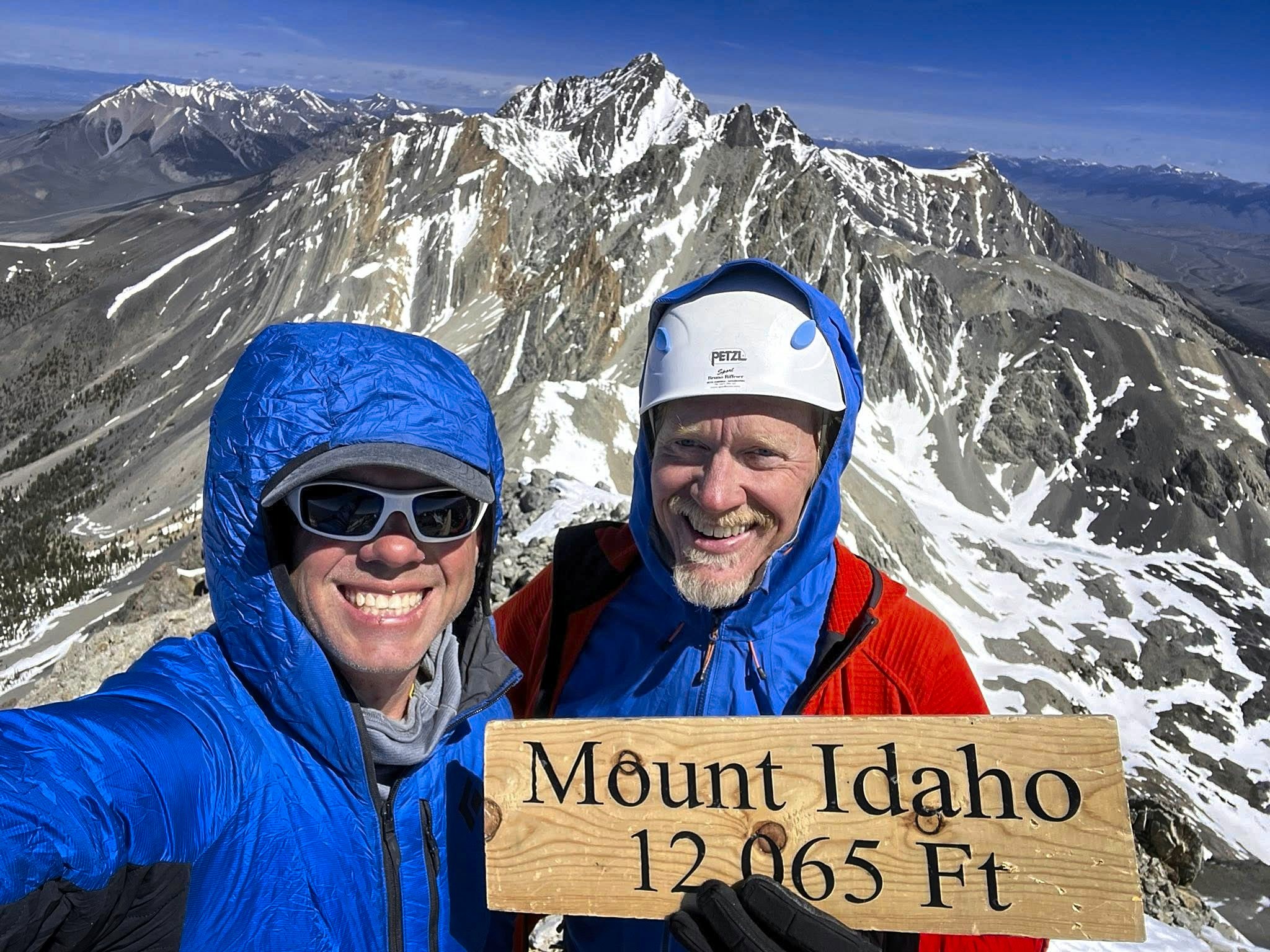
Sean and I on top
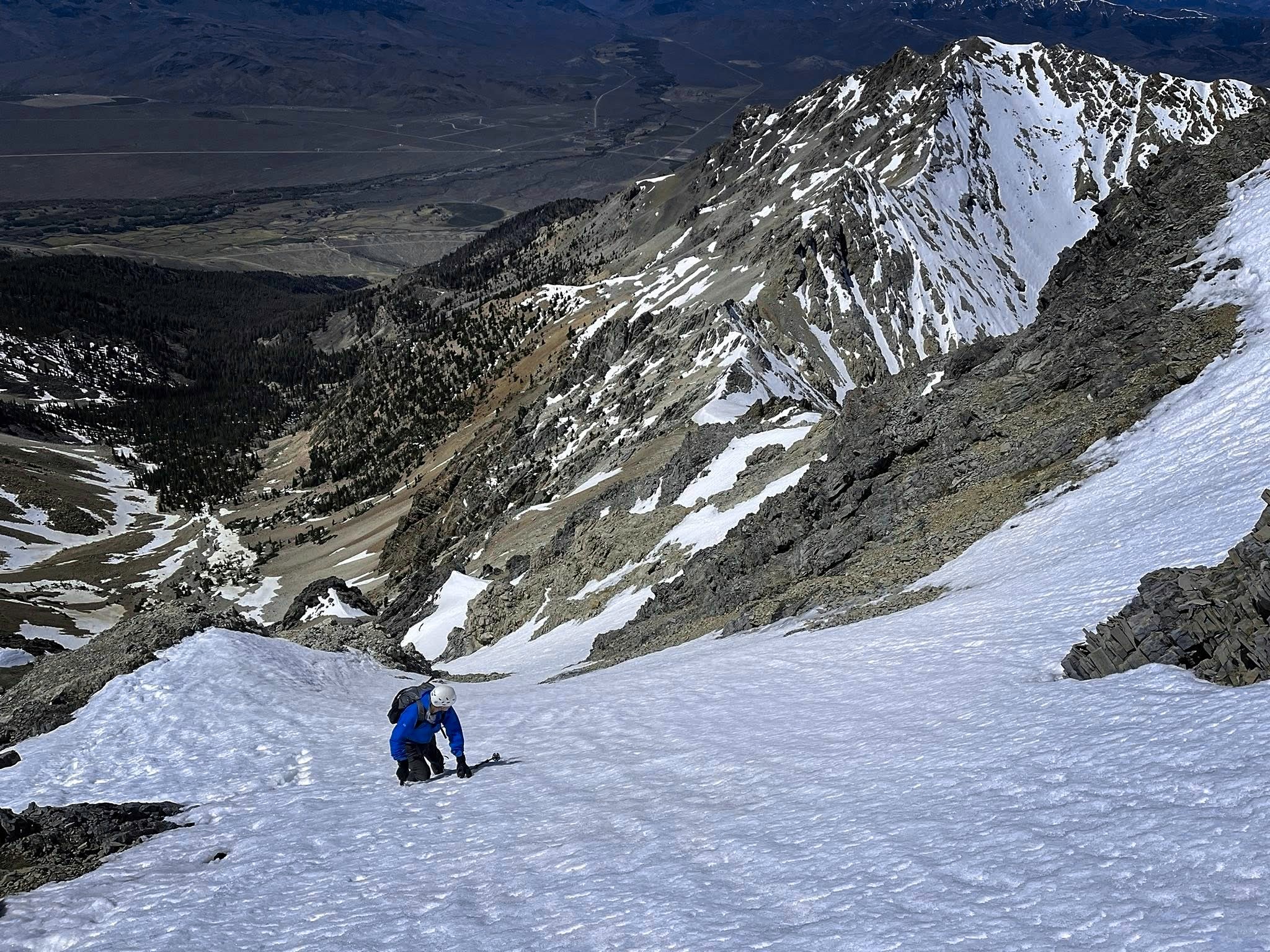
Michael looking over to the last chance to traverse to the ridge crest, or go down
But we were through! We looked back at the wall of cliffs, marked by runnels of frozen waterfall, and were amazed at our line. "I'd like to come back and climb up it!" said Sean. He was right, it would make a wonderful ascent route in frozen snow.
We were soon in a pleasant forested valley, rather unlike most of my Lost River Range experience so far. Usually in sound range of a babbling brook, we pieced our way down forest, creek bank, and boulderfields. However, there were cairns absolutely everywhere. Within a half-mile and 400 feet vertical patch of ground, we saw at least 30. They didn't only appear in logical places. Once I was far to the side to get around a fallen tree, then made a poor choice to keep traversing while Sean headed straight down. Both his and my path were anyway marked by 4 individual cairns (or "rock stacks" as Sean calls 'em).
I marked our way through the Wall
A look back up at our exit point from the Wall
We're happy we made it through the "Wall"
They were certainly not placed there by Forest Service officials. We'd seen cairns on the ridge crest, say, at the point marking where you'd turn right onto the face for the snow traverse. Or at a point on the ascent corresponding to the map where one could profitably exit the stream bed for a trail of sorts on the left side. These were fine. But this new cavalcade of cairns appeared to be decorative, often simply marking the well-trod trail every 10 feet or so.
We knocked many of these over. The creek itself was the route. Sections of tread connected one side to the other in a natural way. What else do you need? I thought back on the other climbs of this amazing spring, and rememberd the occasional cairn. They never dominated the experience. The overall experience was one of self-reliance. I've never done so much off-trail travel in my life before Idaho. But now I'm getting used to it as the norm. If there is a trail, it's a bonus that speeds the journey. But no longer required. And if I'm utterly confused for some reason, I have a phone with a GPS, and a little red dot showing my position on a hillside, possibly marked in addition with a way trail, or even a GPS track I downloaded from somewhere. I think most people have such a device today.
I pictured the wave of "new" climbers, like me, excited about climbing the 12k peaks of the state. As part of a new "herd," in a state with a large influx of new people, I didn't want to change the fundamental character of the wild lands I explored. Sean had been here a long time, climbing more than 40 peaks over 11k feet, and he'd never seen such an array of cairns on a hillside. Therefore, I decided, it's better to have an opinion against over-cairning the way, because it preserves traditional Idaho ideas about the way and the wilderness.
Eventually we were down in pretty warm sagebrush country again, marvelling over the great ascent and all the thoughts and actions of the day. We bumped down the road in my truck. I dropped Sean off at his car at the base, and we headed back to the settlements of home. Thanks for a good trip!
Thanks to the weather, the Creator, the mountain. What a good time! 5350 feet up and down.